
Noll’s new road, driving and bicycle map of Philadelphia and surrounding country. Philadelphia: E.P. Noll & Co. 1893.

$750
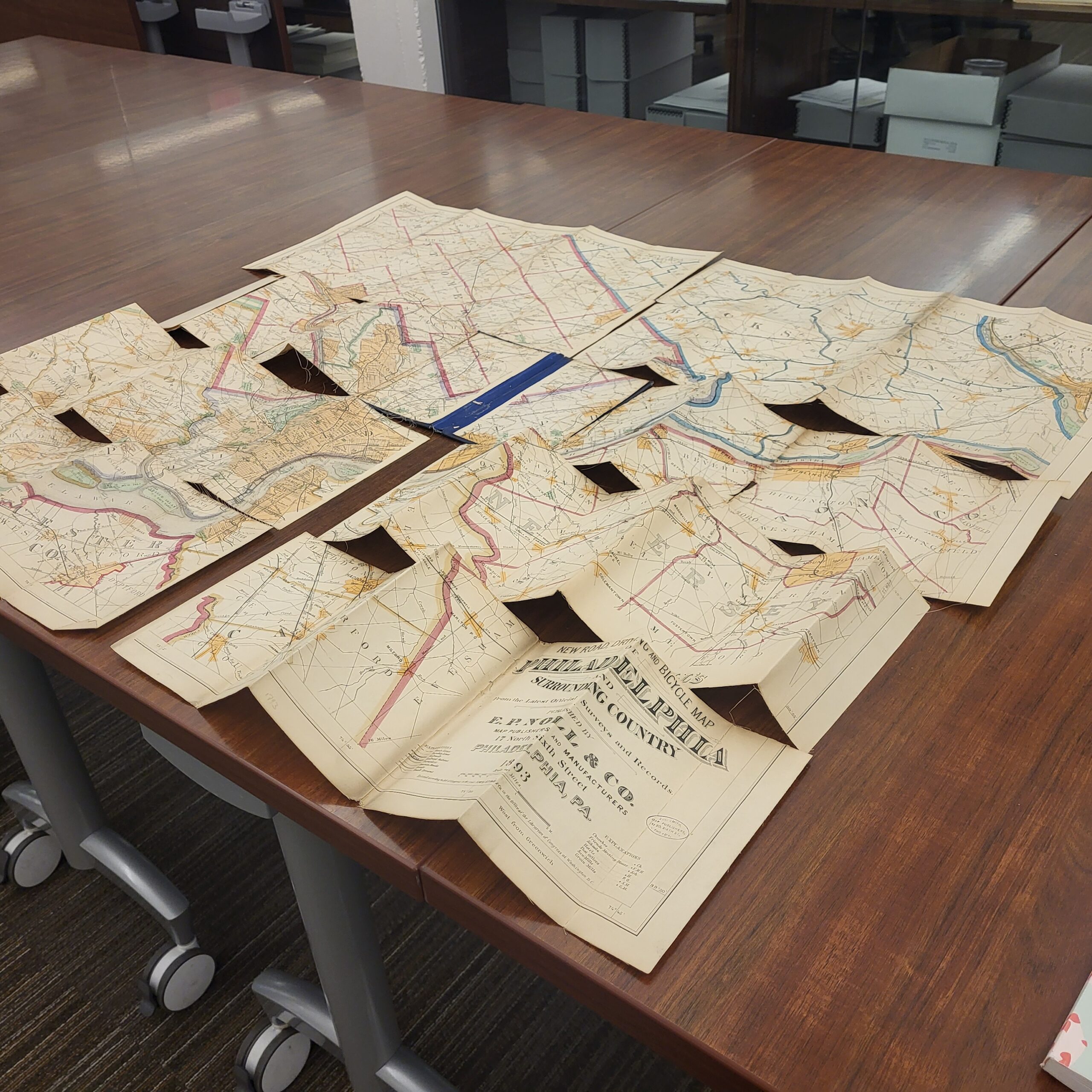
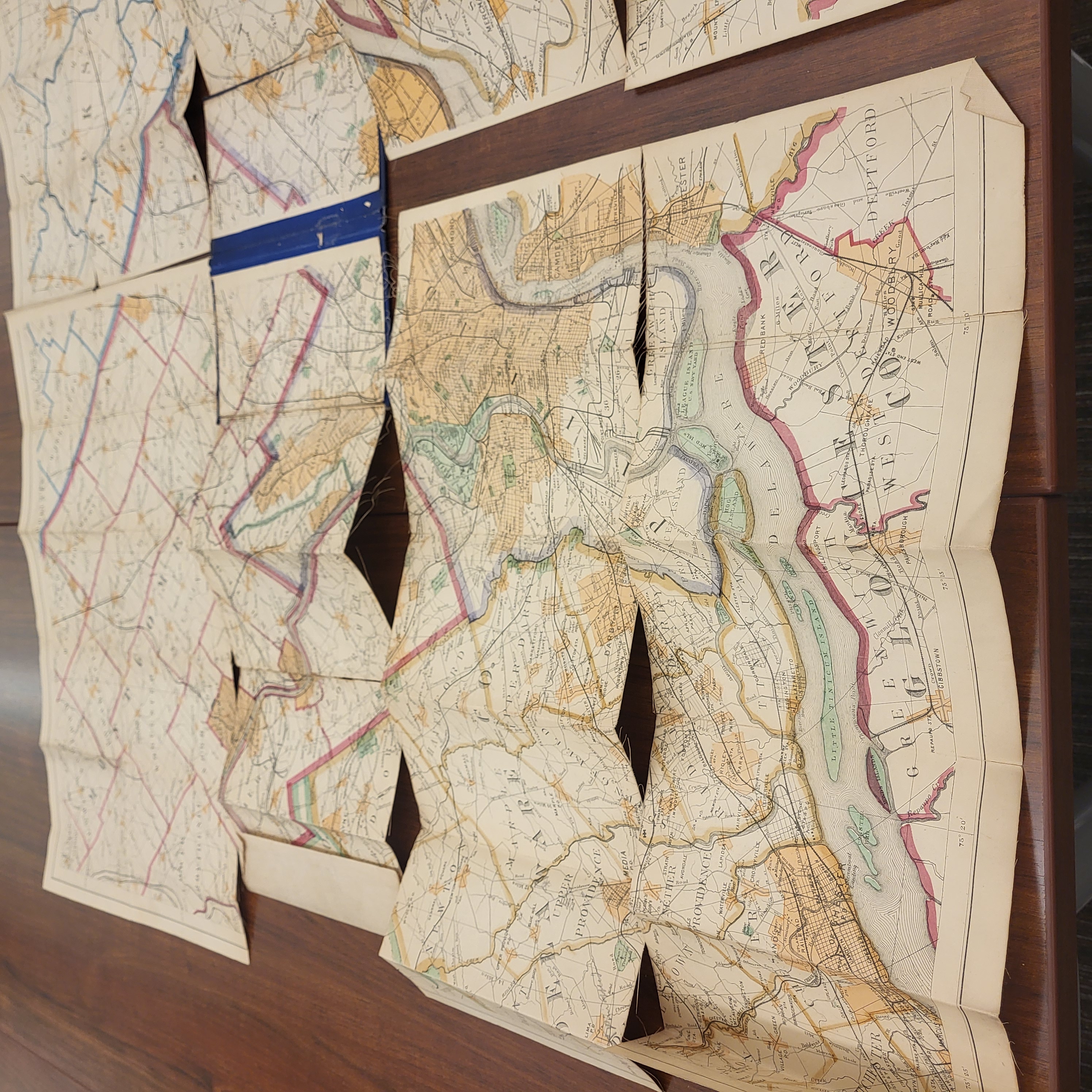
Noll’s road map was the guide for traveling in 19 th century Philadelphia. The detailed, hand-colored map of the city shows roads, railroads, and the location of churches,schools, hotels, Friends meeting houses, and more! The Clements Library owns this 1893 edition and a later 1911 edition, comparing the maps side-by-side highlights the growth and change of Philadelphia and the surrounding region.
Conservation Treatment
The map was originally issued backed with cotton and folded several times into a cloth cover. At present, the map is fragmented along many of the fold seams and unusable. The donation for conservation treatment will include testing the inks used in the hand-coloring, removing the old lining, removing the portions of the map attached to the cover, and relining the map into its original two halves. After conservation, the map will be stored in an archival map folder with the original cover.