TINY THINGS
No. 60 (Fall/Winter 2024)
Table of Contents
A Plan for Your Pocket
Sierra Laddusaw
Curator of Maps & Graphics
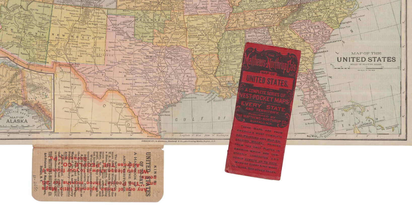
The Matthews-Northrup firm rose to prominence as the publishers and printers of railroad maps, which required a level of detail also demonstrated in their Map of the United States.
When prompted to think about “tiny things,” maps may not be the first objects that come to mind. However, I invite you to think about how you use maps on, possibly, a daily basis: through the phone in your pocket. We use map applications on our phones for guidance when driving and navigating unfamiliar cities, as a reference on how to get from point A to B, and to decide on the closest place to grab lunch. A convenient map in your pocket isn’t a new idea; today’s digital maps are modern technology’s answer to the pocket maps of the past.
In the United States, pocket maps were first retailed to the public in the 1820s. Major American map publishers, including Samuel Augustus Mitchell (1792–1868), Henry Schenk Tanner (1786–1858), and Anthony Finley (1784–1836), produced pocket maps that highlighted the growing road and railroad networks. Pocket maps of the 19th century were printed and folded into slipcases or covers made of thick paper, cardboard, and—for deluxe printings—leather. The map itself was typically printed on paper, though sometimes the map would be mounted on linen to help reduce the wear and tear of regularly folding and unfolding the paper. Pocket maps were designed to be disposable, with publishers regularly releasing updated editions.
The smallest pocket map at the library, when folded into its cover, measures 13.2 × 5.8 cm. Map of the United States, published by the Matthews, Northrup, & Co. in 1891, is a vest pocket map showing the boundaries between the states, location of cities, and the routes of major transportation networks. Alongside a brief history of the country, the back of the map is printed with a variety of quick facts, including a list of past Presidents and Vice Presidents, military statistics, and a list of “Fifty Famous Americans.” The publisher also makes good use of the cover to advertise their “handsomer,” “handier,” and “always up to date” maps of every state, offered for sale at fifty cents a map!

