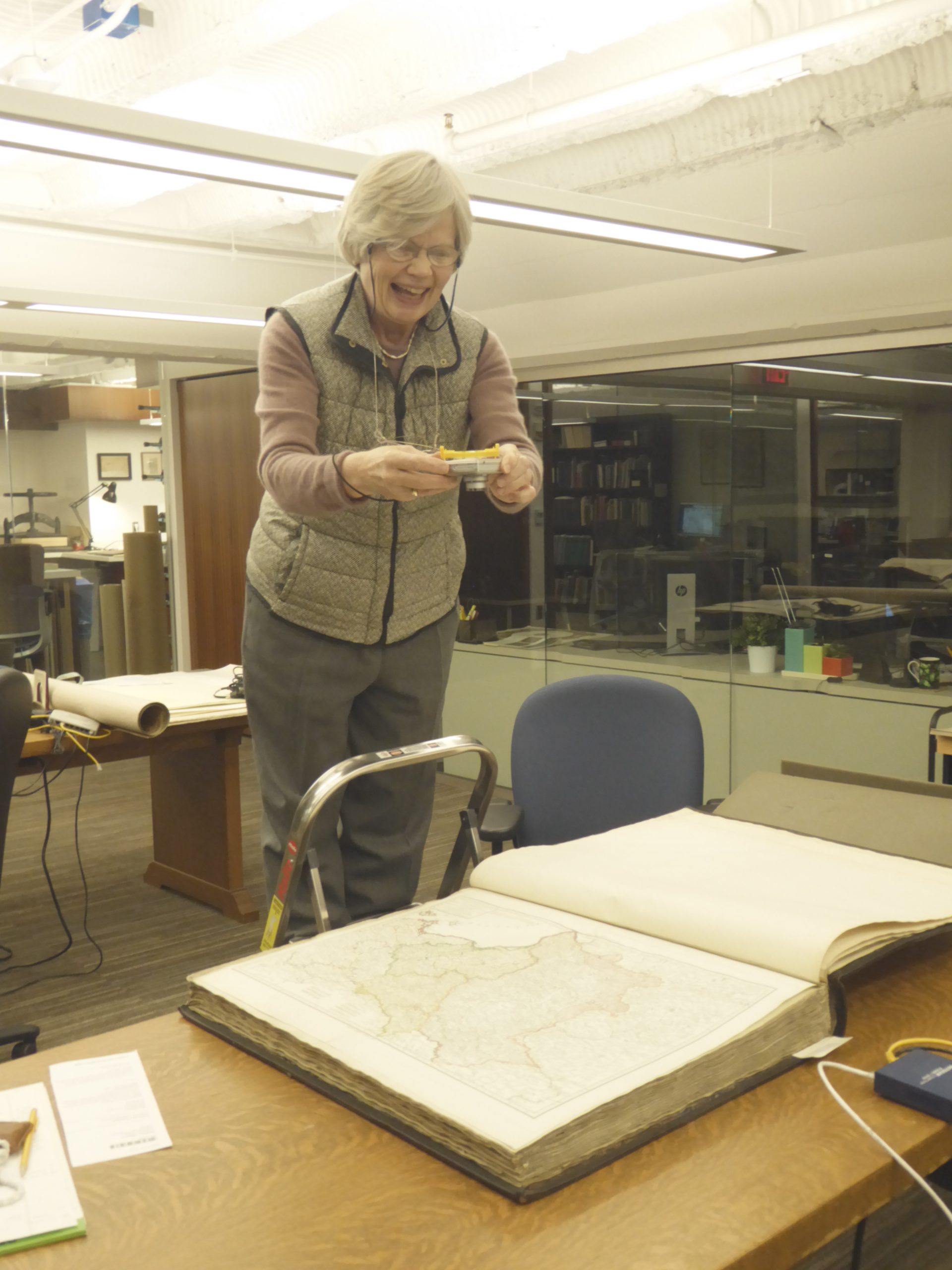
Mary Pedley demonstrates the skills of balance and focus required of an assistant curator of maps.
Many years ago, a fellow map librarian said to me, “If you want to study old maps, be ready to do gymnastics.” Those words stuck in my mind as I undertook to help a Dutch colleague by photographing all the maps in a series of Dutch atlases in our collection. As the picture shows, this endeavor is definitely a gymnastic affair. A ladder is required to get sufficient height to take in the sometimes very large maps folded inside the atlas. The sheer weight of some volumes demands muscle tone and core strength to move them around. So why, the reader asks, is such a performance necessary at all? Aren’t these atlases described sufficiently in our catalogue?
No, they are not. Sometimes we simply do not know what our atlases are, and occasionally it is only the title, name, and date on the spine that informs the catalogue entry. This is because for the great centuries of atlas production in Europe– the 17th and 18th — there was no standard format for an atlas, which was merely a collection of maps. An atlas could be assembled by a collector, a printer, a geographer, a publisher, and bound at the time of collection or many years, if not decades, later. To add to the confusion, because there were no copyright laws, and privilege only extended to the country of origin, maps were often copied and re-printed in a different city, sometimes with nothing changed, not even the printed place of production. Thus it can be difficult, for example, to distinguish an original map by the well-known French geographer Guillaume Delisle published in Paris from the excellent copy made by Pierre Mortier in Amsterdam.
Sorting out copies from originals, random collections from designed productions, requires the expertise of a map scholar who closely studies all the known copies of particular atlases and creates a catalogue that may be consulted by map librarians to identify what is in their local collection. Such a catalogue exists for Dutch atlases, the Atlantes Neerlandici, first published by Cornelis Koeman in the 1970s, and now being updated and expanded by Peter van der Krogt. As van der Krogt was working through the atlases produced by Pierre Mortier, Covens and Mortier, Pierre Husson, Nicolas Visscher, Frederick de Wit, and Carolus Allard, he noticed many atlases associated with these names in the Clements Library. The easiest way for him to consult these twenty atlases was for his old friend and colleague Mary Pedley to photograph them and for him to tell us what they are.
The result of this effort will be a closer and more refined identification of what we have in our rich collection of atlases, an improved catalogue entry for each of them, and a visual digitized record for readers to consult who cannot visit the library in person. A winning project all around and worth every minute on the ladder!
Mary Sponberg Pedley
Assistant Curator of Maps
