
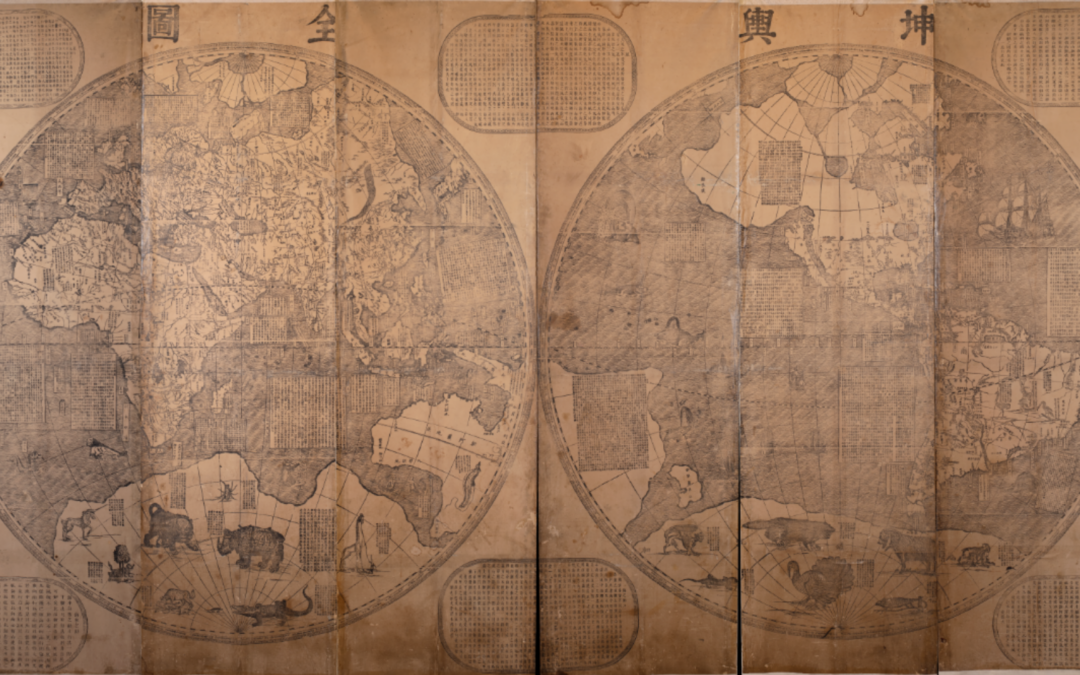
Verbiest’s Complete Map of the World Pt II: The Man Behind the Map
Who was Ferdinand Verbiest and why did he create a world map?
Who was Ferdinand Verbiest and why did he create a world map?
Last month, we hosted a “What’s In Your Attic?” open house-style events where members of our community brought their own paper treasures (letters, journals, photographs, prints, books, and maps) for discussion with Clements Curators and guest Americana collectors. A handful of our guests generously chose to donate materials to the Clements Library at this event, here are a few of those newly donated acquisitions!
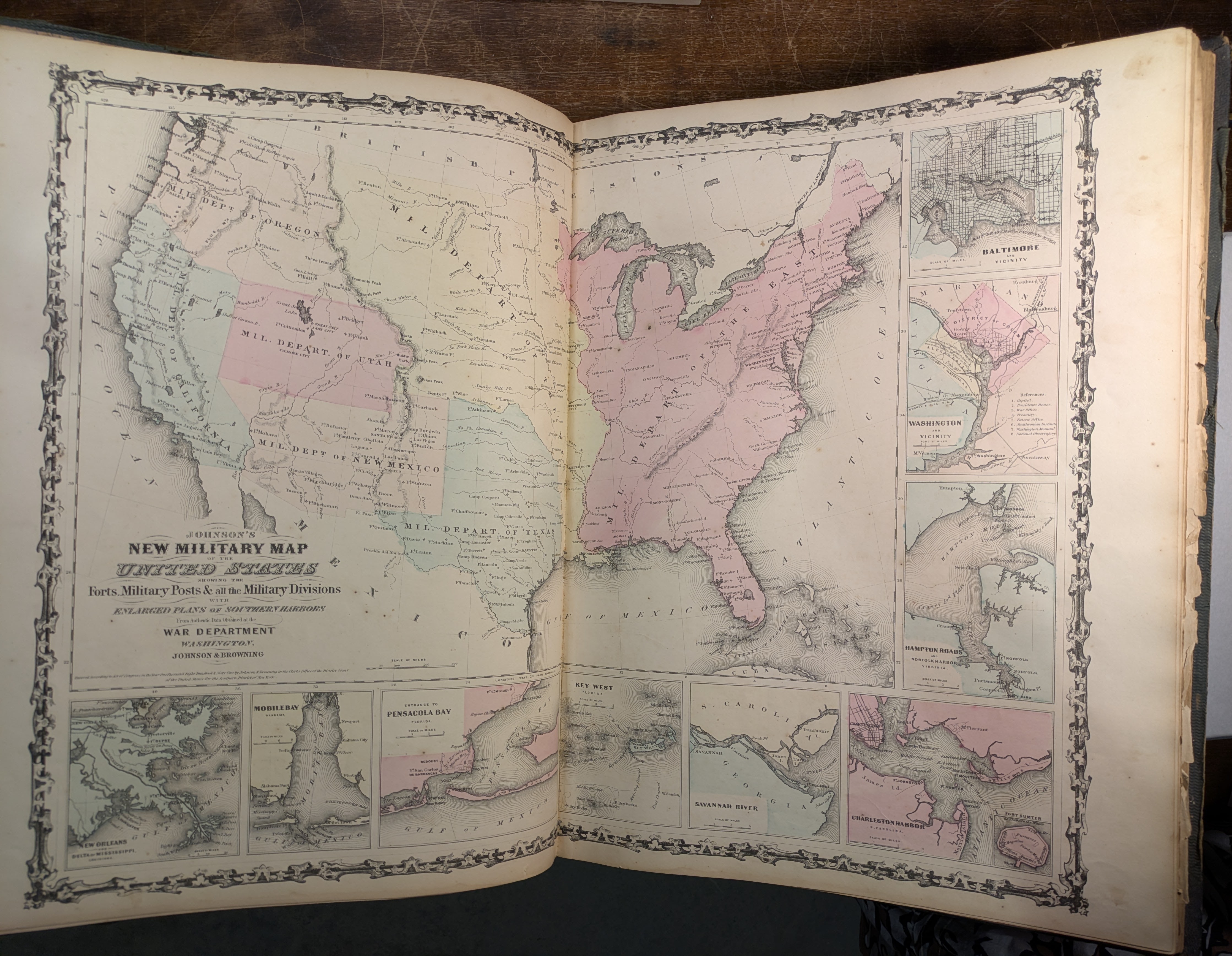
The Maps Division has added three family atlases to the Clements Library holdings. In 19th century America, these atlases were popular with the general public and combined hand-colored maps with descriptive text about geography, history, and culture of the world.

In this Q&A, Clements Conservator Julie Fremuth and Curator of Maps & Graphics Sierra Laddusaw discuss a significant 1800s map of Texas, Oregon, and California, sharing insights on its historical value and the conservation work that our copy required.
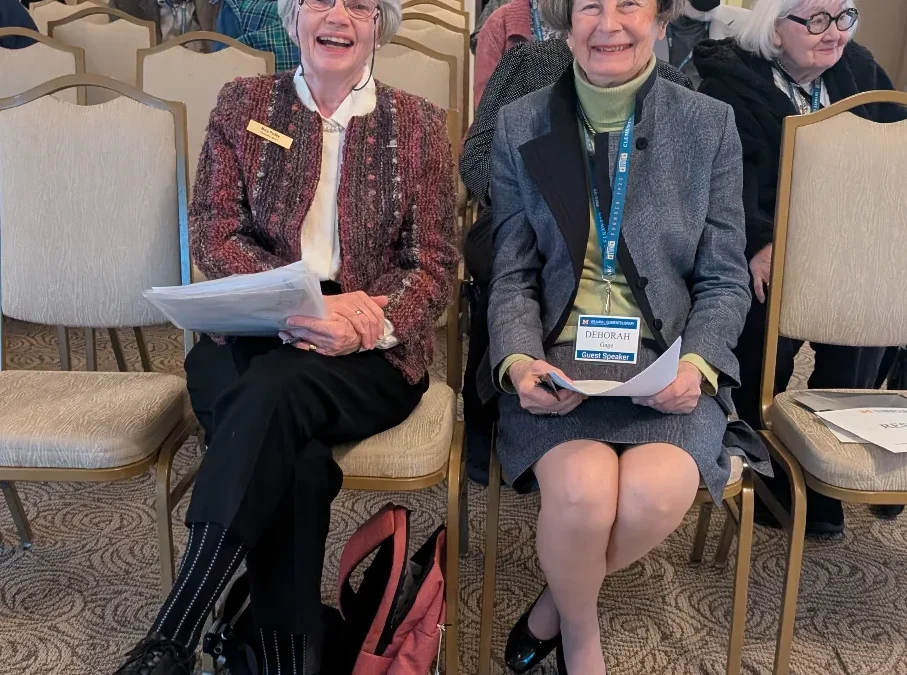
The Thomas Gage papers, which have been housed at the Clements Library since William L. Clements himself purchased and donated them in 1937, give unique insight into the Revolutionary War from the British perspective. However, they also greatly inform the reader about everyday life in the colonies prior to the revolution. It is this aspect of the Gage story that Deborah Gage, a descendant of General Gage, focused on during A Conflict of Emotions: Thomas and Margaret Gage and the American Revolution on Wednesday, April 2, 2025.

Buried within a small, leather-bound memorandum book that’s part of the Hudson’s Bay Company materials at the William L. Clements Library lies a two-page map, charted circa 1779 by John Thomas of London, depicting a consequential but nonexistent waterway connecting Lake Superior with Hudson’s Bay. The search for this fictitious waterway led to the aggressive expansion of the HBC. Read on to learn more.