by Sam Huck | Apr 9, 2025 | Collections, Events, Manuscripts, Maps, Public Programs
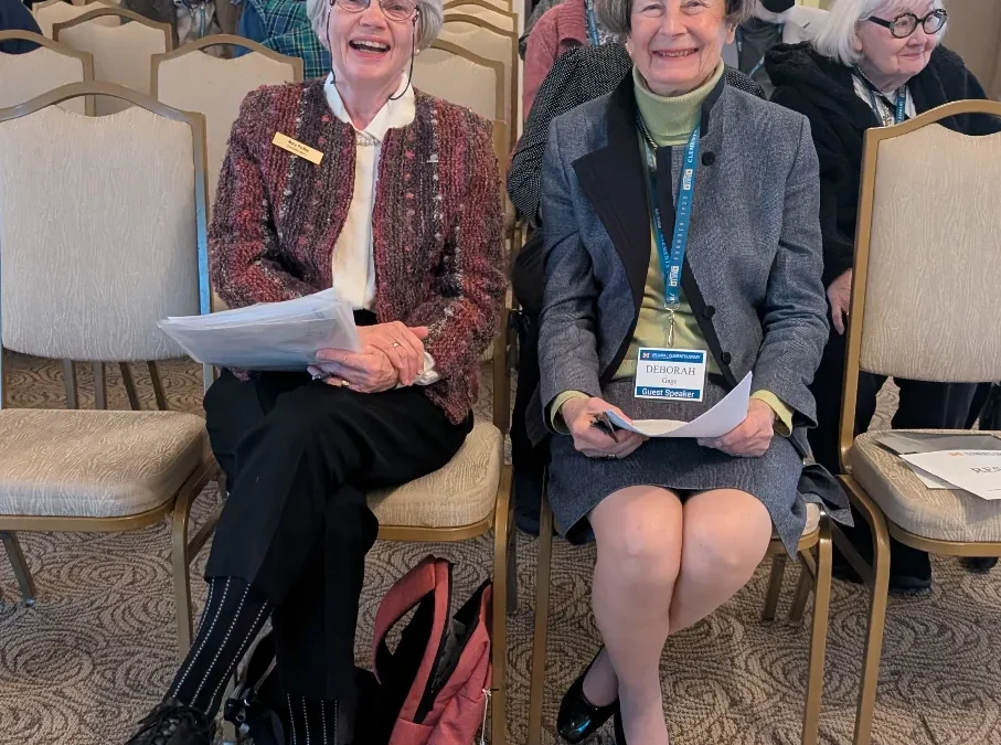
The Thomas Gage papers, which have been housed at the Clements Library since William L. Clements himself purchased and donated them in 1937, give unique insight into the Revolutionary War from the British perspective. However, they also greatly inform the reader about everyday life in the colonies prior to the revolution. It is this aspect of the Gage story that Deborah Gage, a descendant of General Gage, focused on during A Conflict of Emotions: Thomas and Margaret Gage and the American Revolution on Wednesday, April 2, 2025.

by Clements Library | Oct 1, 2024 | Collections, Manuscripts, Maps
Buried within a small, leather-bound memorandum book that’s part of the Hudson’s Bay Company materials at the William L. Clements Library lies a two-page map, charted circa 1779 by John Thomas of London, depicting a consequential but nonexistent waterway connecting Lake Superior with Hudson’s Bay. The search for this fictitious waterway led to the aggressive expansion of the HBC. Read on to learn more.

by Tiffani Ihrke | Jan 24, 2024 | Featured, Graphics, Library Work, Maps, News
In January 2024, Sierra Laddusaw joined the University of Michigan community as the Curator for Maps and Graphics at the Clements Library. Sierra comes to Michigan from University of Arkansas – Fort Smith where she was the Scholarly Communication Librarian....
by Tracy Payovich | Dec 1, 2021 | Acquisitions, Featured, Giving, Maps, News
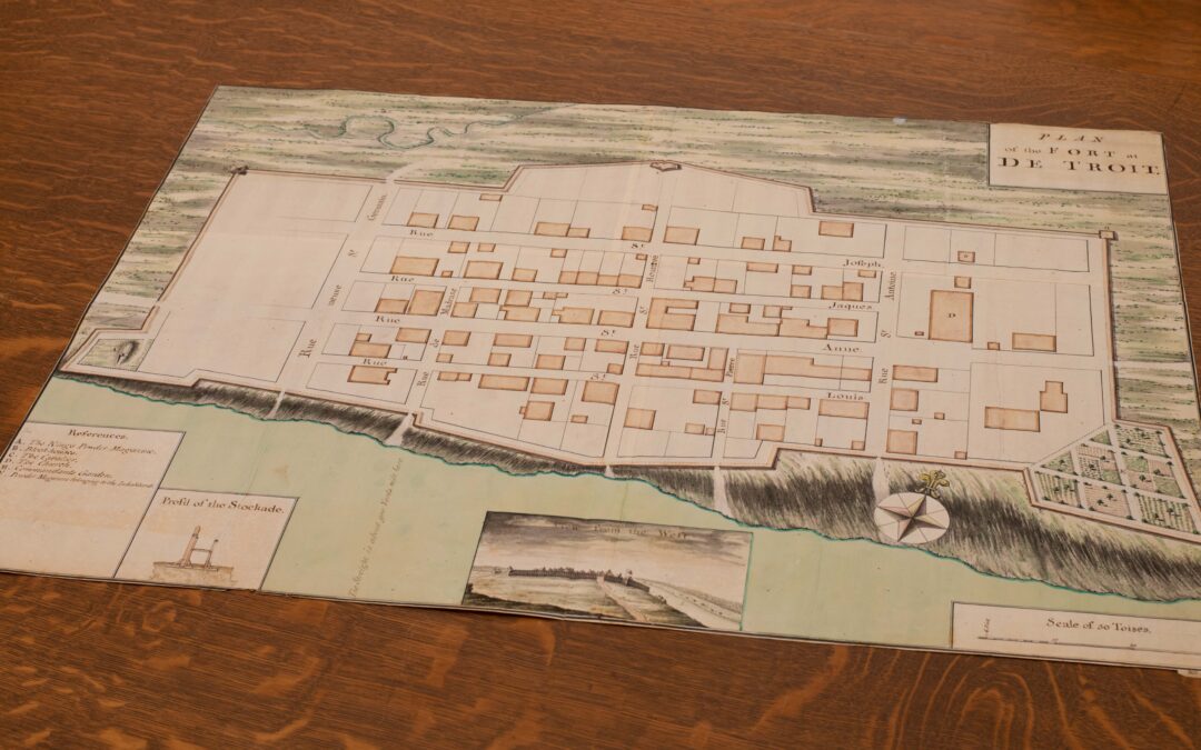
The last time the general public had the opportunity to see the “Plan of the Fort at De Troit” was in 1967 when it was offered for sale at Sotheby’s. Now it will be part of the University of Michigan’s William L. Clements Library collection. Not knowing to whom the...

by Clements Library | Sep 23, 2021 | Featured, Maps
This image comprises all the engraved segments of a half-size facsimile copy of a medieval manuscript map known as The Peutinger Map. The engraved facsimile is found in later editions of the Theatrum Orbis Terrarum, edited and published by Abraham Ortelius (and often...

by Clements Library | Jun 29, 2021 | Featured, Fellowships, Maps
Guest post by Danny Zborover; 2020-2021 Mary G. Stange Fellow at the Clements Library; [email protected] *** As the pirates disembarked their ship and prepared to attack, another group of black-attired characters formed a solid line behind the defensive wall. After a...

by Clements Library | Oct 6, 2020 | Featured, Maps, News, Publications
Mary Pedley, Assistant Map Curator at the Clements Library, is co-editor with Matthew H. Edney of The History of Cartography Volume 4: Cartography in the European Enlightenment (University of Chicago Press 2019). * * * The old adage about pictures and words has...
by Clements Library | Jul 30, 2020 | Featured, Giving, Library Work, Maps
To create a digital archive is an expensive endeavor. The Clements Library is deeply committed to sharing its rich collections with an ever-wider audience, but the queue of material is long and resources limited. Pockets of the collection would not see cyber-light...

by Clements Library | Jun 2, 2020 | Collections, Featured, Library Work, Maps
Clements Library Conservator Julie Fremuth provides a follow-up to our recent post about the arrival of 14 tightly-rolled sea charts and early conservation steps. The initial post Conservation Close-up: Sea Charts used in Whaling discusses Fremuth’s months-long...