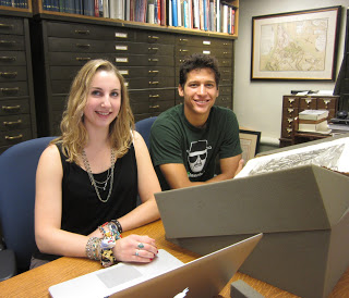
Mary Pedley’s former Latin students have found new opportunities with cartography. Two of her former students, both classics majors, were seeking summer internships at U of M that would use their talents with ancient languages. Hannah Sorscher studies at the University of Chicago and Henry Upton at Kenyon College. With the encouragement of Brian Dunnigan, Map Curator at the Clements, and Karl Longstreth, map curator in the Clark Library, Mary Pedley proposed to them the collation (identification and indexing) of all the Ortelius atlases in the collections of the Clements Library and the Graduate Library of the University. They worked through most of the summer under the supervision of Pedley, Dunnigan and Longstreth, Using a number of bibliographical tools, printed and on-line, they were able to identify all the maps, their states, and editions of the Ortelius atlases in the University collections. They converted their findings in a useful spreadsheet, allowing the curators to know at a glance what is in the collection.
Atlases are often the last thing to be fully catalogued in any collection; their size and the complexity of the maps they contain often defeat the curator pressed for time in keeping up with other demands of the collections. To have student interns, who are also adept at the language, in this case Latin, was a great help. Hannah and Henry were able to give their Latin a Renaissance workout and their classical interests were further piqued by the maps of the ancient world in Ortelius’ Parergon, one of the first thematic collections of printed maps of ancient literature and history.

