Guest post by Juliet Wiersema; 2025-2026 Brian Leigh Dunnigan Fellow; [email protected]

Frontispiece

Orienting map
The large manuscript atlas, A Description of all the Ports … in the South Seas of America … is tied to an infamous tale of Pacific piracy. In 168o, English buccaneers, under the leadership of captain Bartholomew Sharpe, sailed from Jamaica to the northern side of Panama. In the Caribbean, they ditched their ships and proceeded to trek across the Isthmus of Panama on foot, a journey which—even with the help of the Guna, an Indigenous people of the Darien isthmus—took over 30 days. Once in the Pacific, the pirates leveraged Indigenous allies and their canoes to capture unsuspecting Spanish vessels and, with these, rebuilt their fleet.
A year into the voyage, Sharpe and his men overtook a Spanish ship known as the Rosario. From the Rosario’s hold, the pirates scored brandy, wine, and silver as well as a valuable book of sea charts for the South Sea (today’s Pacific Ocean). These charts and sailing directions represented highly guarded intelligence about an ocean that had been claimed and jealously guarded by Spain for the past two centuries. As an earlier Portolan chart by Battista Agnese (1541) indicates, much of this coast was terra incognita, unknown territory.

Battista Agnese, Nautical Atlas of Battista Agnese (detail), 1541, Library of Congress
The stolen book of Spanish charts—called a derrotero, or sea rutter—was taken back to England and gifted to king Charles II. Copies were made by a Thames School chart maker named William Hacke. Fourteen of these copies survive today in U.S. and British collections, referred to as South Sea Waggoners or Hacke Atlases. We are fortunate that one of these atlases resides in the Clements Library, acquired in 1979.
A Description of all the Ports … in the South Seas of America … contains 182 maps that chart the coastline of North and South America, beginning north of Acapulco and moving south towards Tierra del Fuego. At the time this atlas was created, c. 1698—two centuries before the creation of the Panama Canal—the Pacific Ocean was a sea less traveled. Navigators aiming to reach the Pacific had to sail from the Atlantic and make the fraught passage through the Straits of Magellan or sail into the Caribbean, abandon their ships (as Sharpe and crew did), and make the long trek across the densely tropical Isthmus of Panama.
What makes the Clements Hacke Atlas so compelling is that—while full of maps—it is minimally concerned with cartography. Instead, Hacke seems to be most interested in identifying commercial opportunities like the rich silver mines of Potosi or places where cotton, indigo, and cocoa can be obtained. There are also mentions of shipwrecks that might result in the discovery of long buried treasure.
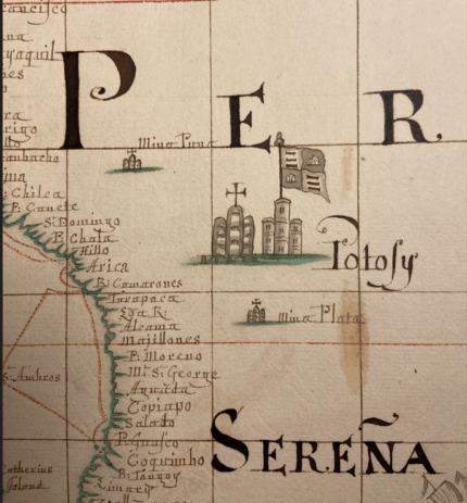
Detail of an orienting map showing Potosi and other mines
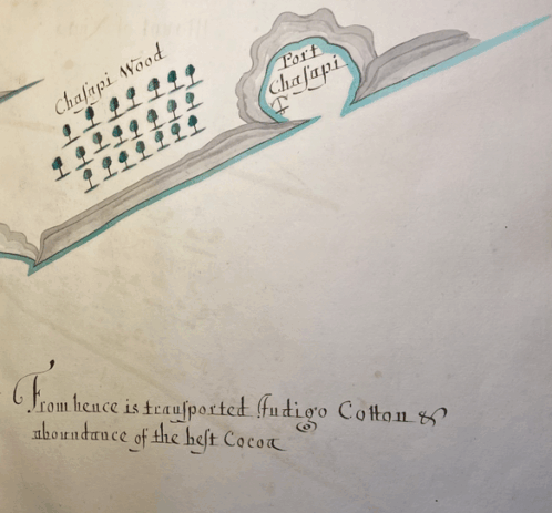
Detail of Map 10, “From hence is transported Indigo, Cotton, and an abundance of the best Cocoa”
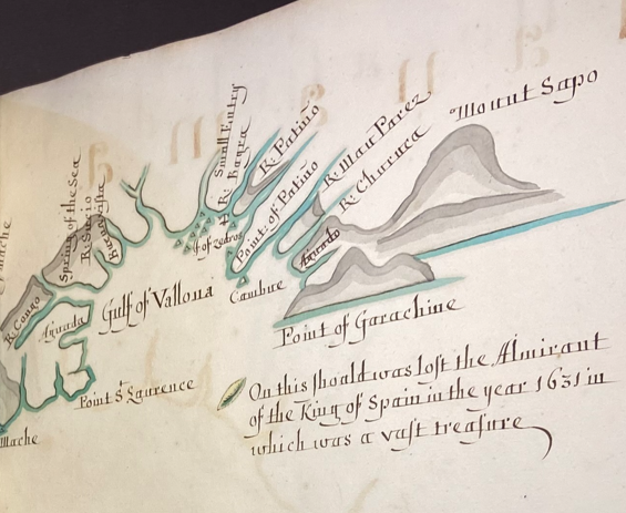
Detail of Map 65, “On this shoald (shoal) was lost the Almirant of the King of Spain in the year 1631 in which was a vast treasure”
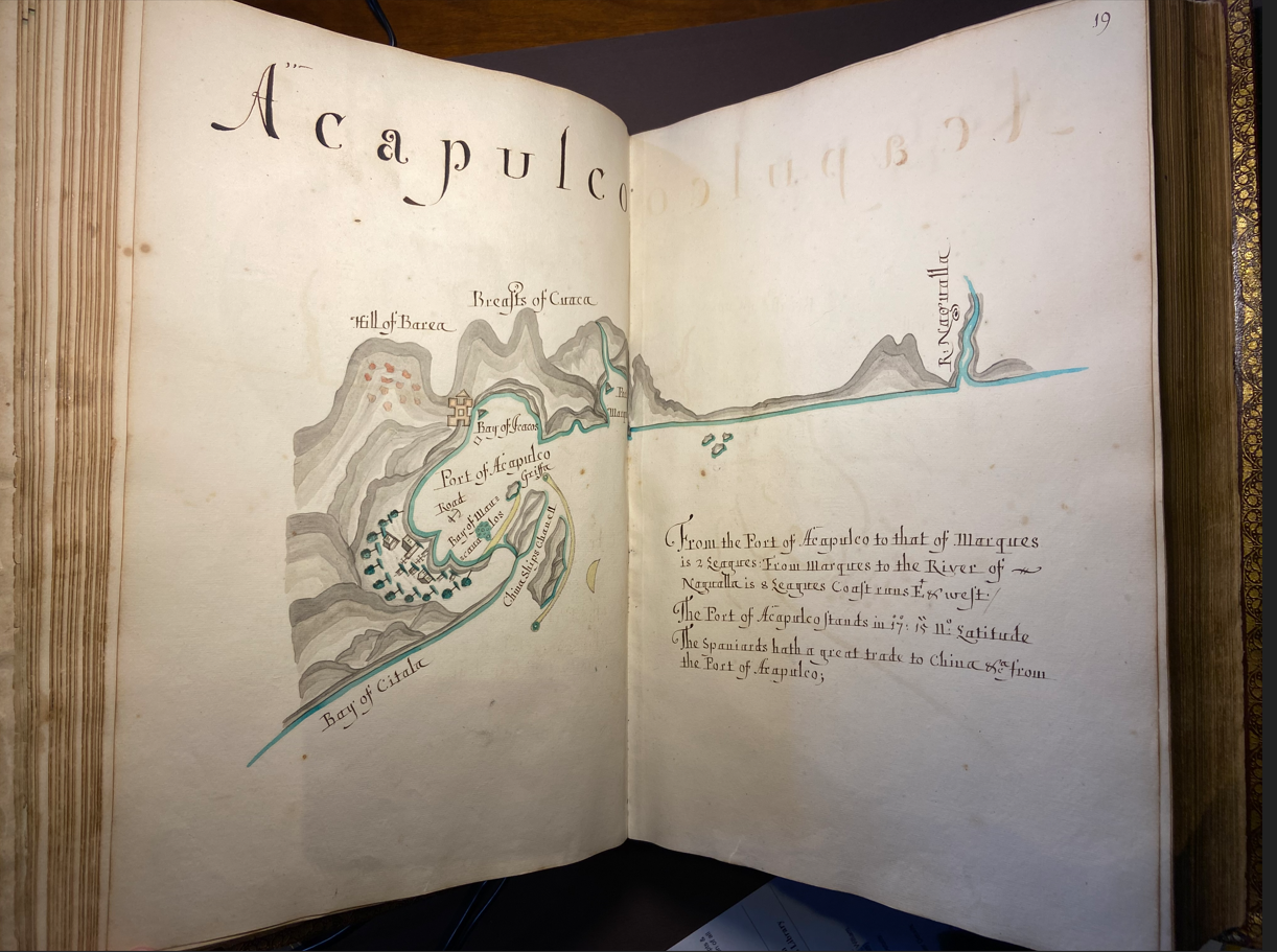
Map 19, Acapulco
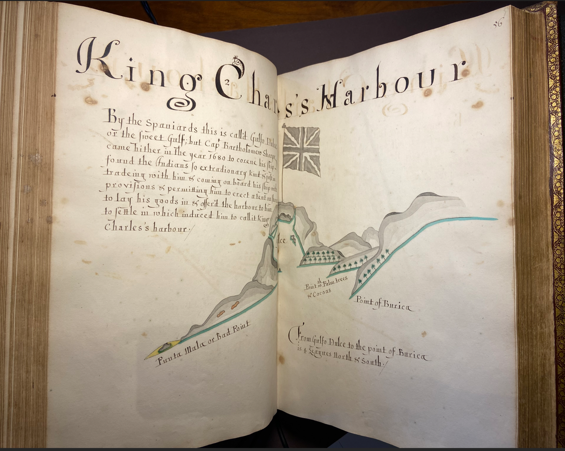
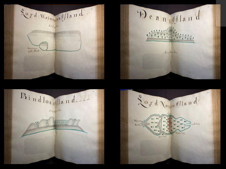
Hacke also uses maps in this atlas to lay English claim to territory already claimed by the Spanish. For example, Hacke renames Gulfo Dulce (just north of Chiriqui, Panama) King Charles Harbor, after Charles II. Hacke additionally has no qualms about inventing the islands’ morphology, as we see in these maps of the individual islands comprising the Galapagos. These islands are also given “vanity” names, after influential people in the royal government.
My study of the Clements Library Hacke Atlas is part of a larger investigation that undertakes a critical, visual, material, and historical look at the corpus of fourteen known South Sea Waggoners. While every atlas follows a similar format, it is clear that each is unique. The color scheme of the Clements Hacke Atlas exhibits gradients of grey (used for hills) and aqua (used for the coast). Meanwhile, the Hacke Atlas in the John Carter Brown Library (JCBL) is monochrome and the one in the Free Library of Philadelphia is brilliantly colored with generous areas of gold leaf. Each atlas is also textually distinct; some South Sea Waggoners are textually spare while others are more verbose. Informationally, each differs as well, highlighting different types of economic opportunities in the South Sea.
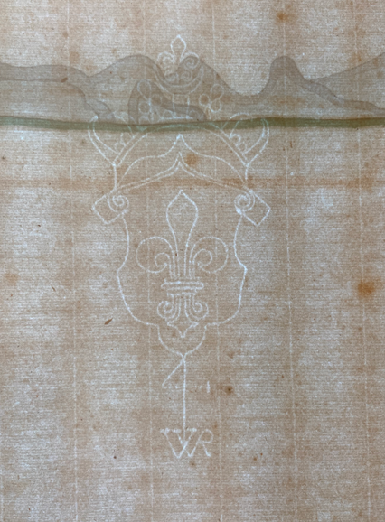
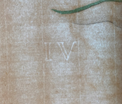
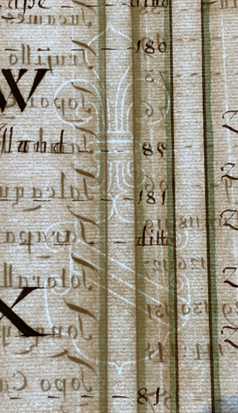
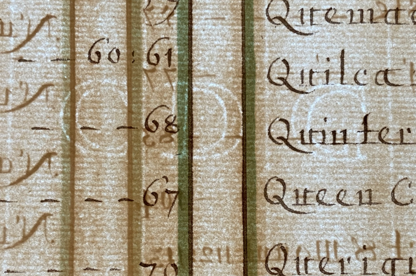
In the course of studying the atlases’ paper, I have found that there is a limited universe of watermarks. The maps of the Clements Hacke Atlas have a Fleur de Lys with IV countermark, while the pages of the table of contents have the Strasburg Bend. Both watermarks are associated with Dutch paper imported to England and are also found in atlases made by Hacke at the JCBL, Free Library, and Library of Congress.
Watermarks have been especially helpful identifying what I refer to as English replicas of Spanish derroteros. These are atlases that have long been believed to be of Spanish or Spanish American manufacture because their accompanying text is Spanish but in fact, the watermarks along with spelling errors reveal them to be English, and perhaps products of Hacke or his workshop. (Spanish derroteros made in Spain or the Spanish Americas are identifiable based on their use of smaller sheets of thinner paper that bear Italian watermarks including the Arms of Genoa or the Three Os.)
To date, I have identified at least three of these English-made replicas of Spanish derroteros. These raise interesting questions about the demand in late seventeenth-century England for cartographic knowledge about the Pacific.

Italian watermarks found in Spanish derroteros. This is the Arms of Genoa.

The Three Os.

Detail of aqua and iron gall ink
My study has also identified pigments used in Hacke’s atlases. In producing the Clements Library’s atlas, Hacke relied on mineral pigments. The aqua used for the coastline is created from a mix of copper, silicon, potassium, sulfur, and calcium. The ink is iron gall, made from a recipe including potassium, silicon, sulfur, aluminum, iron, and calcium.
One of the great mysteries concerning the Hacke Atlases is where the original derrotero stolen from the Rosario might be today. For a time, it was believed that the missing Rosario derrotero was at the Huntington Library (HM 918), but a careful study of its paper and spelling errors indicate it is one of the three English replicas.
With time, continued searching, and a lot of luck, this missing atlas—which spawned the fourteen Hacke Atlases we admire today—will be found. Who knows, you might be the one to uncover its location!