Case 11
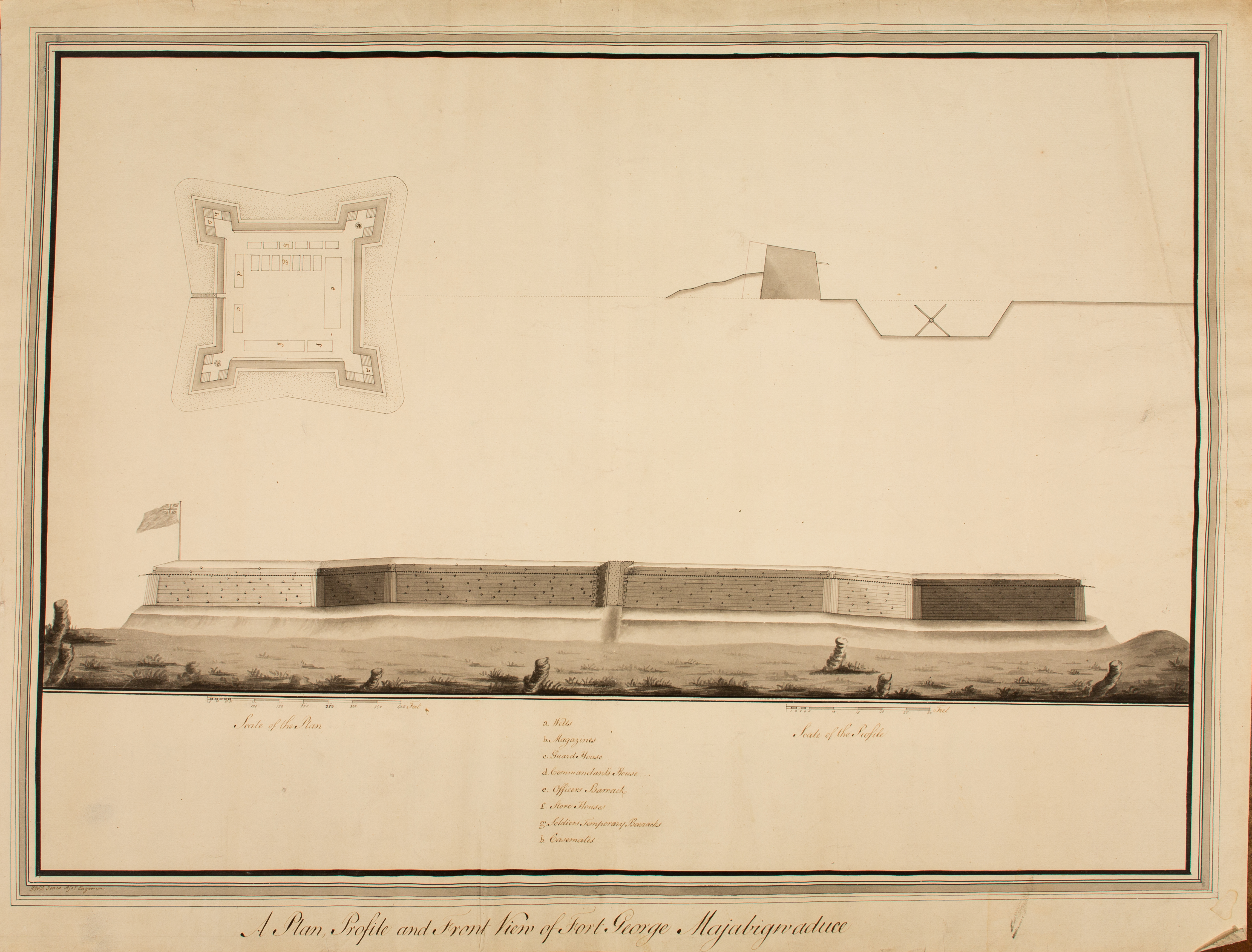
G.W. Dyail Jones, “A Plan, Profile and Front View of Fort George. Majabigwaduce.” Gray wash, pen and ink, [1780]. Henry Clinton Papers, no. 33. Map Division, Maps 4-F-10.
When the British established a post on Penobscot Bay near modern Castine, Maine, in 1779 they constructed Fort George. G.W. Jones recorded its appearance in plan, section, and elevation thus providing a highly detailed view of a logwork fort.
Jones’s creation comprised a square trace with four bastions and a shallow and rather narrow ditch. The fort lacked outworks, glacis or covered way to shield the walls, probably because the ditch excavation provided only enough spoil to fill the logwork. With no glacis or outworks to obscure the view of the fort’s walls, Jones’s elevation provides a very complete impression of the exterior of a logwork wall.


