Case 5
Case 5: Adapting to the Frontier
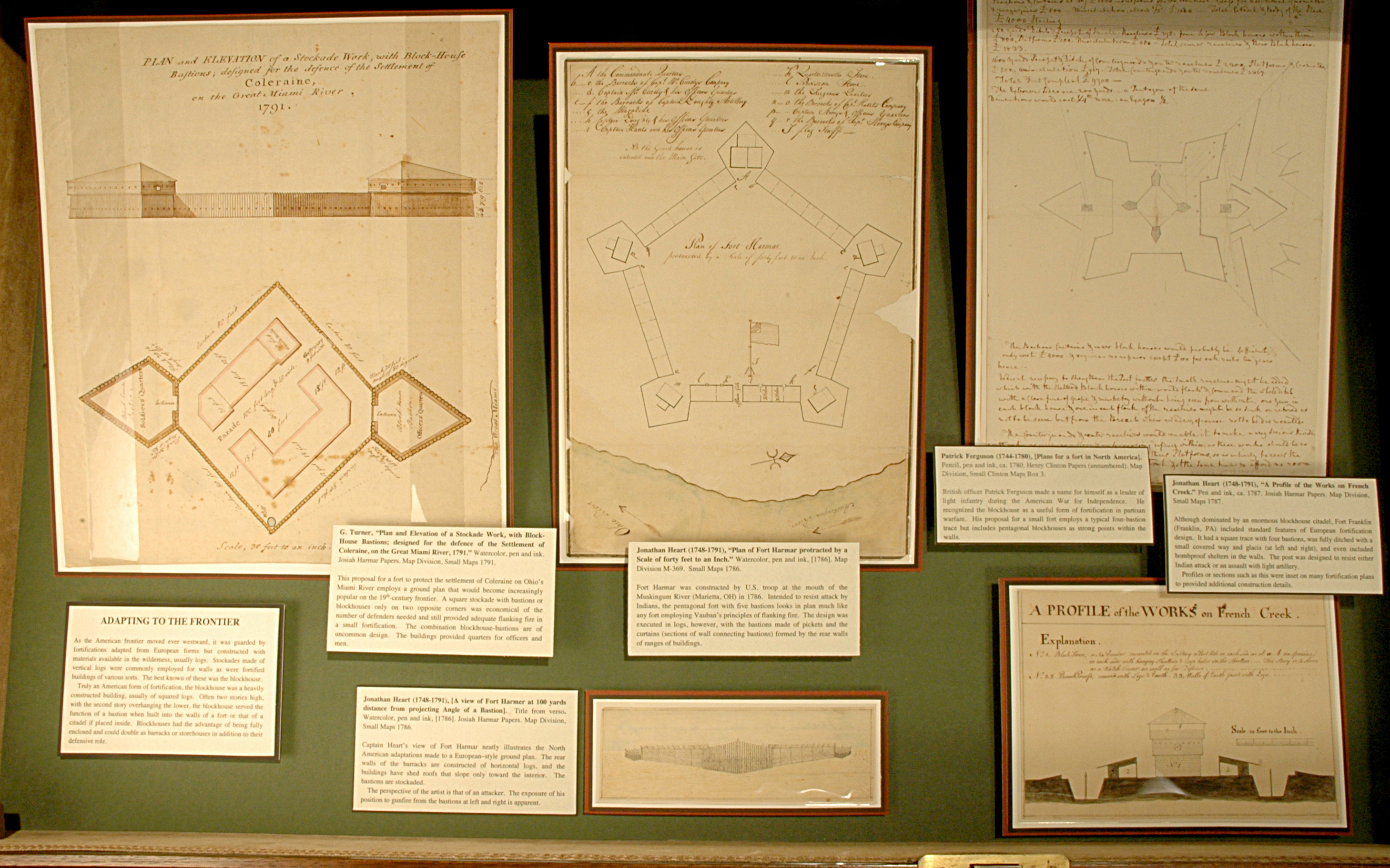
As the American frontier moved ever westward, it was guarded by fortifications adapted from European forms but constructed with materials available in the wilderness, usually logs. Stockades made of vertical logs were commonly employed for walls as were fortified buildings of various sorts. The best known of these was the blockhouse.
Truly an American form of fortification, the blockhouse was a heavily constructed building, usually of squared logs. Often two stories high, with the second story overhanging the lower, the blockhouse served the function of a bastion when built into the walls of a fort or that of a citadel if placed inside. Blockhouses had the advantage of being fully enclosed and could double as barracks or storehouses in addition to their defensive role.

Jonathan Heart (1748-1791), “Plan of Fort Harmar protracted by a Scale of forty feet to an Inch.” Watercolor, pen and ink, [1786]. Map Division M-369. Small Maps 1786.
Fort Harmar was constructed by U.S. troop at the mouth of the Muskingum River (Marietta, OH) in 1786. Intended to resist attack by Indians, the pentagonal fort with five bastions looks in plan much like any fort employing Vauban’s principles of flanking fire. The design was executed in logs, however, with the bastions made of pickets and the curtains (sections of wall connecting bastions) formed by the rear walls of ranges of buildings.
Jonathan Heart (1748-1791), [A view of Fort Harmer at 100 yards distance from projecting Angle of a Bastion]. Title from verso. Watercolor, pen and ink, [1786]. Josiah Harmar Papers. Map Division, Small Maps 1786.
Captain Heart’s view of Fort Harmar neatly illustrates the North American adaptations made to a European–style ground plan. The rear walls of the barracks are constructed of horizontal logs, and the buildings have shed roofs that slope only toward the interior. The bastions are stockaded.
The perspective of the artist is that of an attacker. The exposure of his position to gunfire from the bastions at left and right is apparent.


G. Turner, “Plan and Elevation of a Stockade Work, with Block-House Bastions; designed for the defence of the Settlement of Coleraine, on the Great Miami River, 1791.” Watercolor, pen and ink. Josiah Harmar Papers. Map Division, Small Maps 1791.
This proposal for a fort to protect the settlement of Coleraine on Ohio’s Miami River employs a ground plan that would become increasingly popular on the 19th-century frontier. A square stockade with bastions or blockhouses only on two opposite corners was economical of the number of defenders needed and still provided adequate flanking fire in a small fortification. The combination blockhouse-bastions are of uncommon design. The buildings provided quarters for officers and men.
Patrick Ferguson (1744-1780), [Plans for a fort in North America]. Pencil, pen and ink, ca. 1780. Henry Clinton Papers (unnumbered). Map Division, Small Clinton Maps Box 3.
British officer Patrick Ferguson made a name for himself as a leader of light infantry during the American War for Independence. He recognized the blockhouse as a useful form of fortification in partisan warfare. His proposal for a small fort employs a typical four-bastion trace but includes pentagonal blockhouses as strong points within the walls.

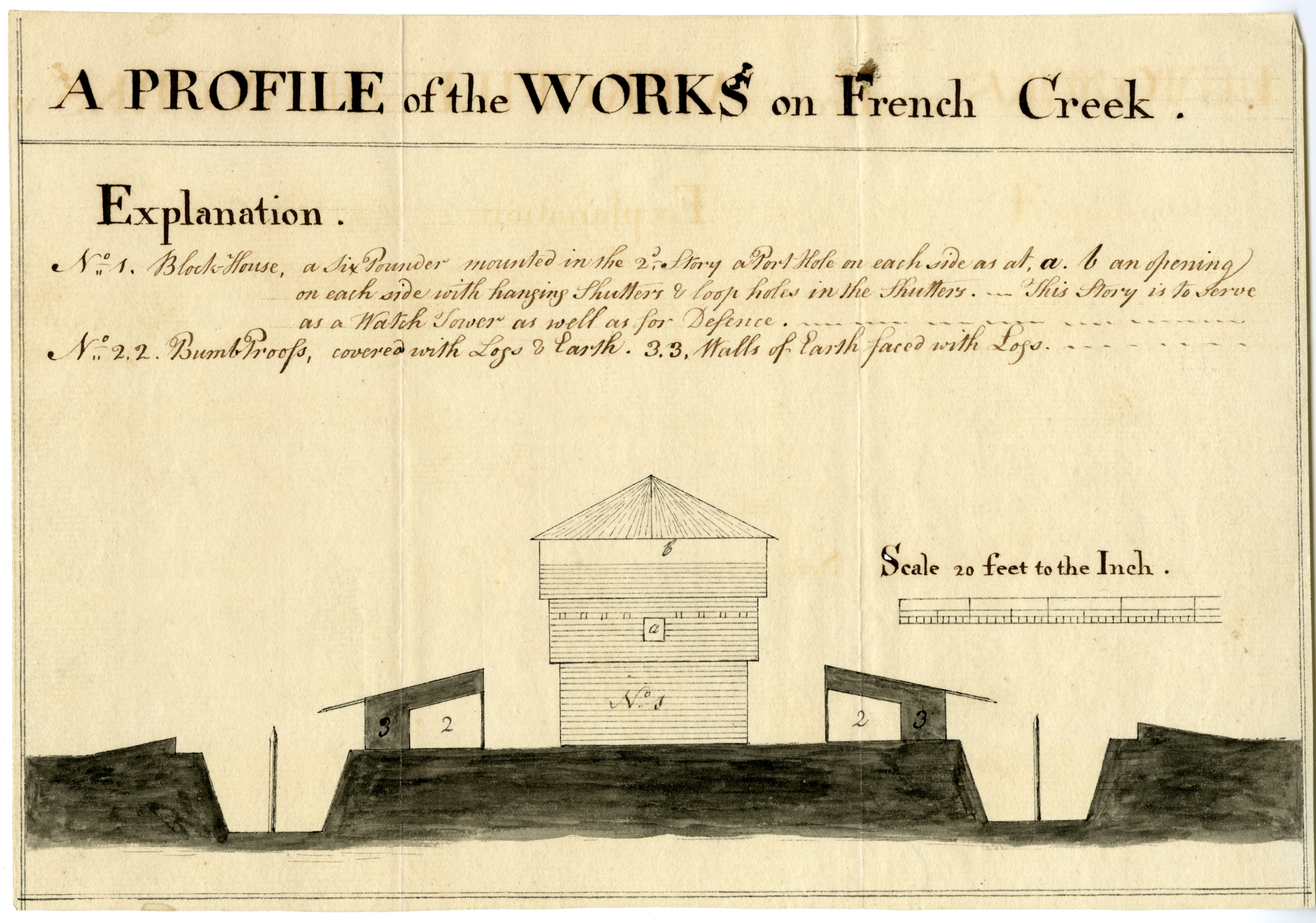
Jonathan Heart (1748-1791), “A Profile of the Works on French Creek.” Pen and ink, ca. 1787. Josiah Harmar Papers. Map Division, Small Maps 1787.
Although dominated by an enormous blockhouse citadel, Fort Franklin (Franklin, PA) included standard features of European fortification design. It had a square trace with four bastions, was fully ditched with a small covered way and glacis (at left and right), and even included bombproof shelters in the walls. The post was designed to resist either Indian attack or an assault with light artillery.
Profiles or sections such as this were inset on many fortification plans to provided additional construction details.