Case 12
Case 12: Sheltering a Garrison
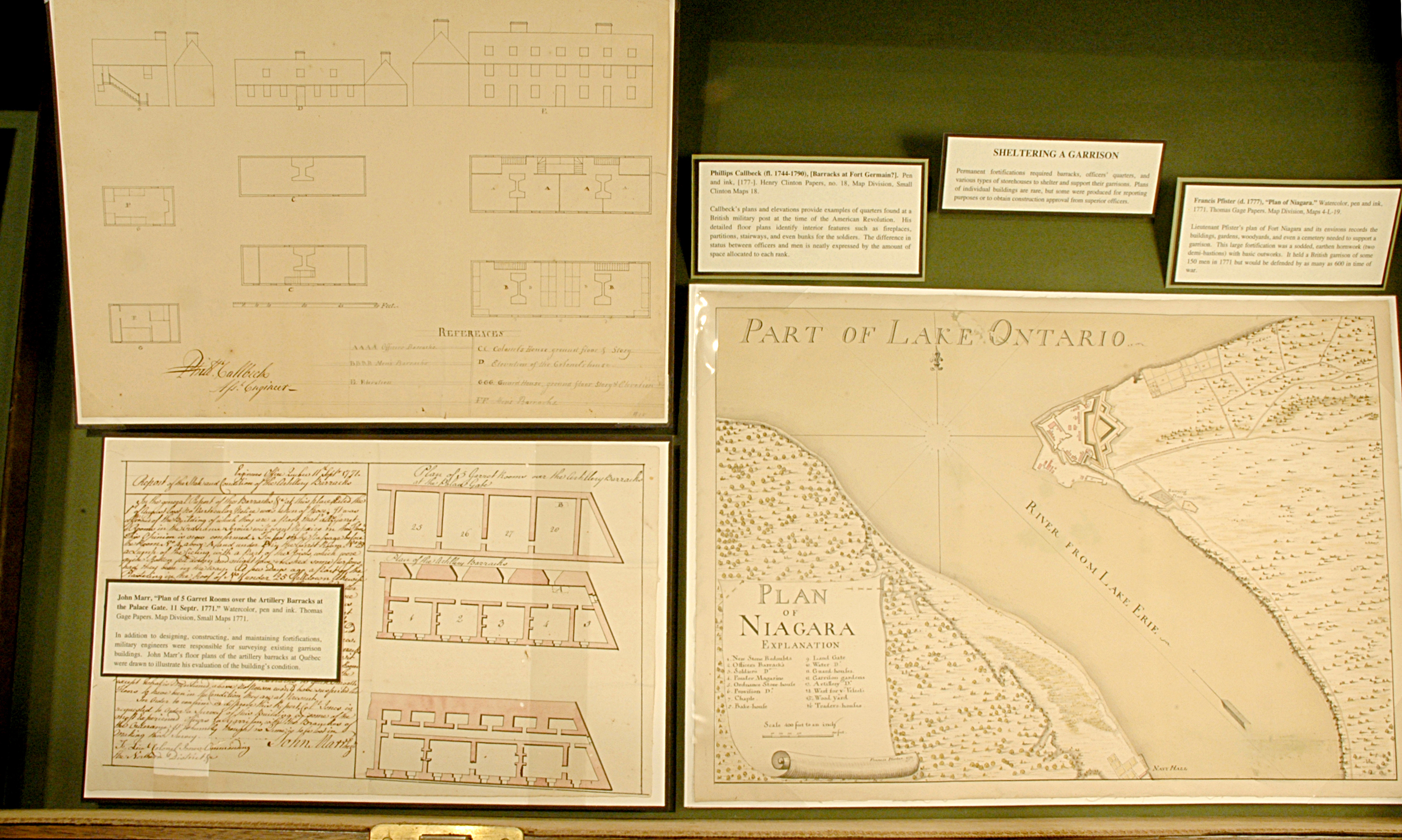
Permanent fortifications required barracks, officers’ quarters, and various types of storehouses to shelter and support their garrisons. Plans of individual buildings are rare, but some were produced for reporting purposes or to obtain construction approval from superior officers.
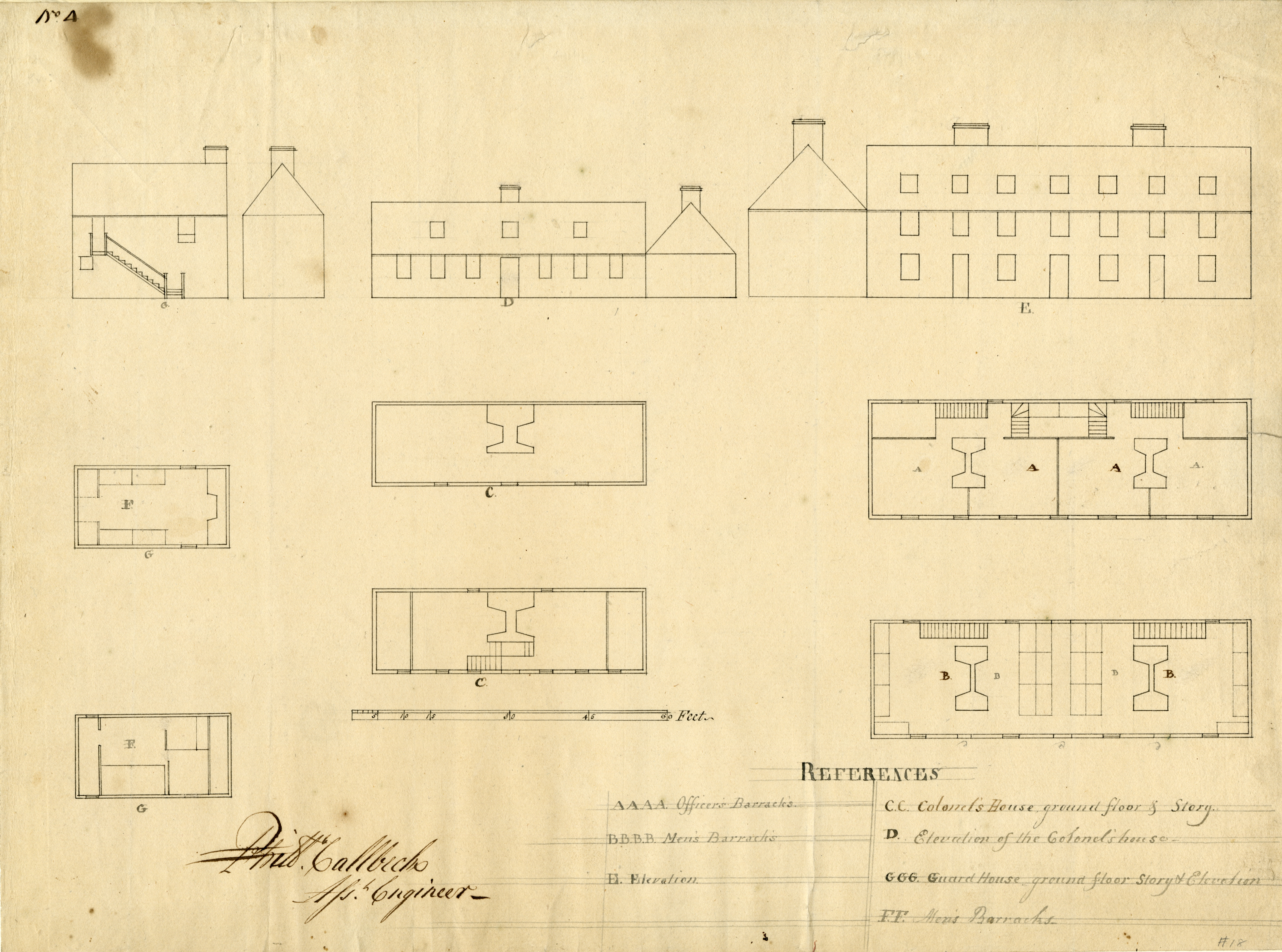
Phillips Callbeck (fl. 1744-1790), [Barracks at Fort Germain?]. Pen and ink, [177-]. Henry Clinton Papers, no. 18, Map Division, Small Clinton Maps 18.
Callbeck’s plans and elevations provide examples of quarters found at a British military post at the time of the American Revolution. His detailed floor plans identify interior features such as fireplaces, partitions, stairways, and even bunks for the soldiers. The difference in status between officers and men is neatly expressed by the amount of space allocated to each rank.
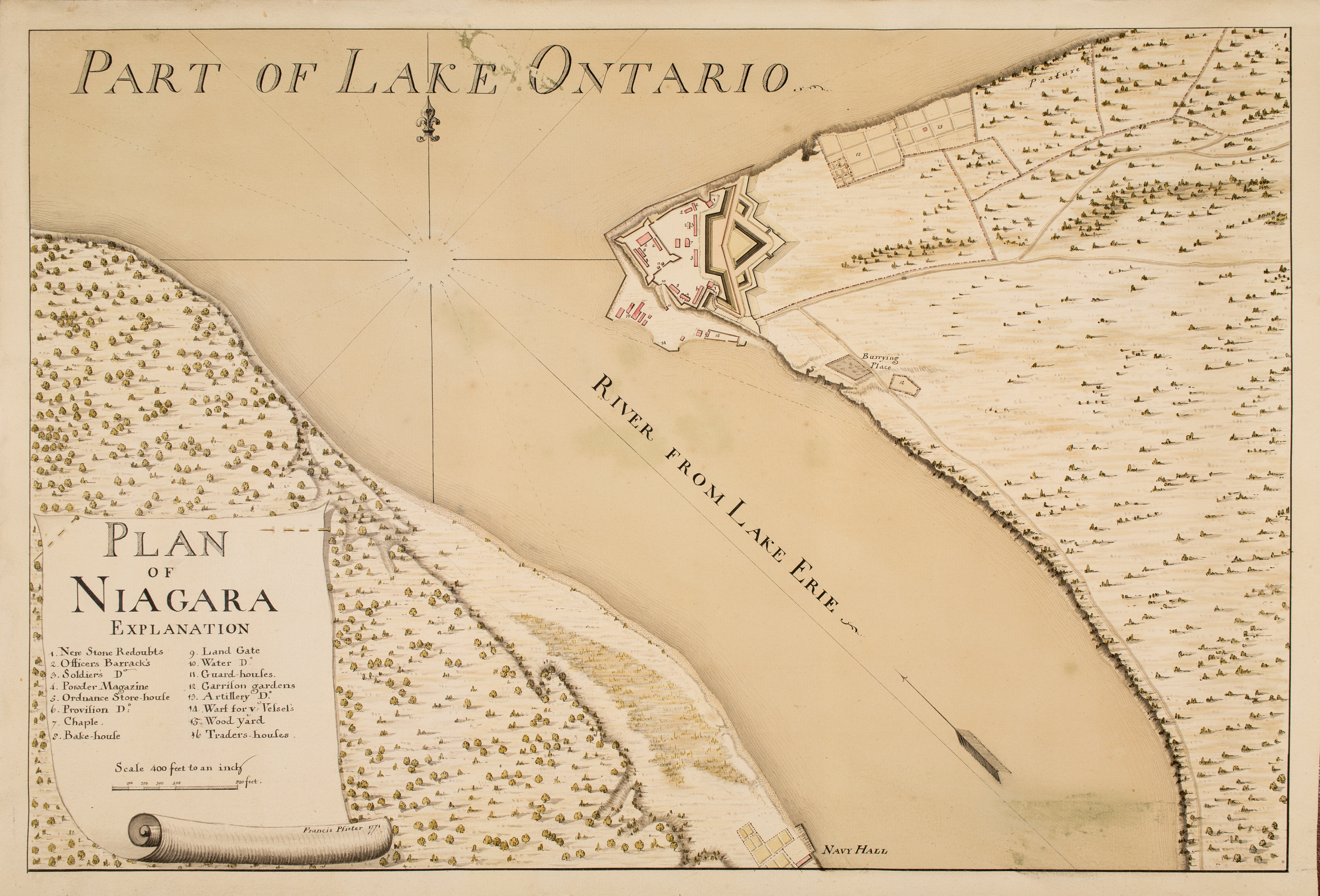
Francis Pfister (d. 1777), “Plan of Niagara.” Watercolor, pen and ink, 1771. Thomas Gage Papers. Map Division, Maps 4-L-19.
Lieutenant Pfister’s plan of Fort Niagara and its environs records the buildings, gardens, woodyards, and even a cemetery needed to support a garrison. This large fortification was a sodded, earthen hornwork (two demi-bastions) with basic outworks. It held a British garrison of some 150 men in 1771 but would be defended by as many as 600 in time of war.
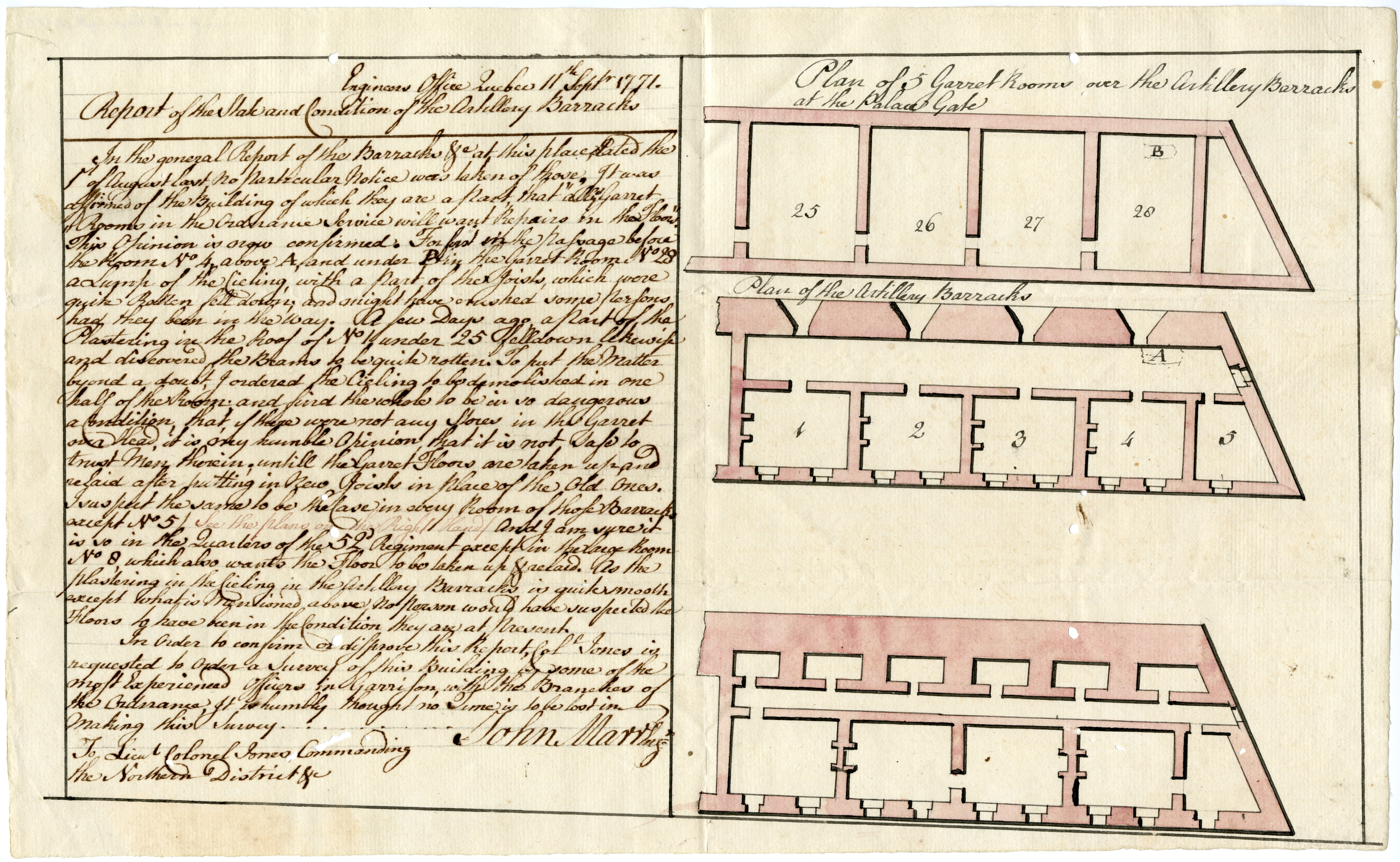
John Marr, “Plan of 5 Garret Rooms over the Artillery Barracks at the Palace Gate. 11 Septr. 1771.” Watercolor, pen and ink. Thomas Gage Papers. Map Division, Small Maps 1771.
In addition to designing, constructing, and maintaining fortifications, military engineers were responsible for surveying existing garrison buildings. John Marr’s floor plans of the artillery barracks at Québec were drawn to illustrate his evaluation of the building’s condition.