Case 3
Case 3: A Variety of Forms
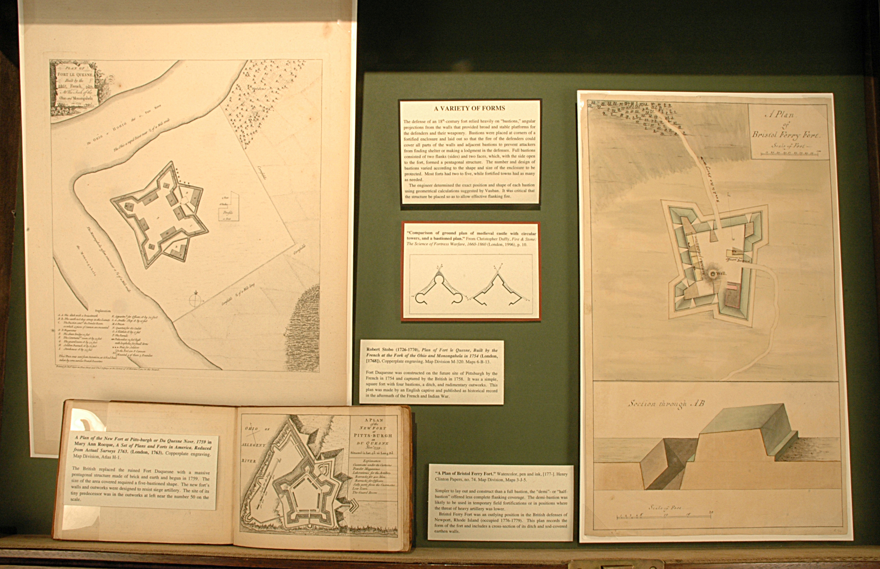
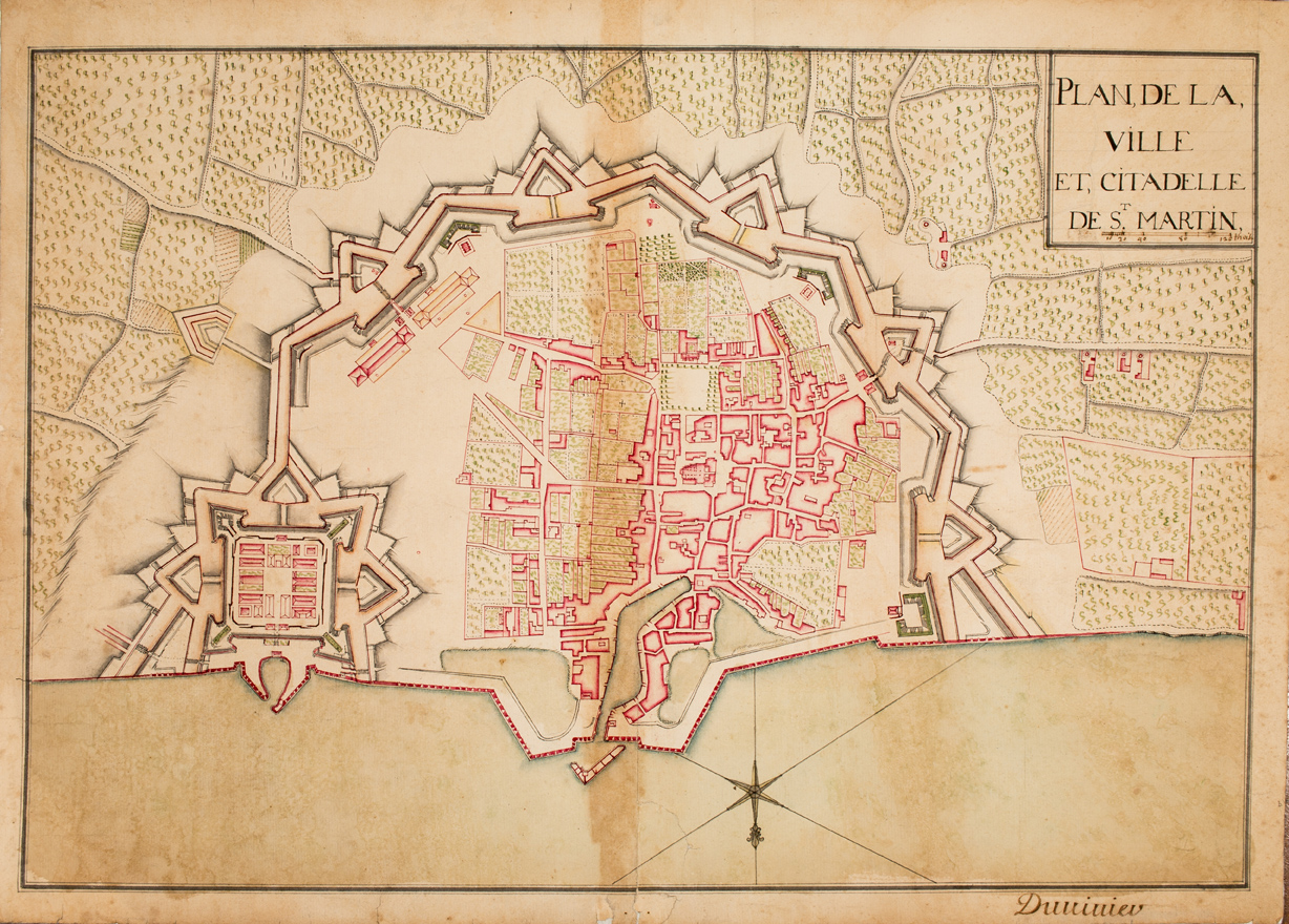
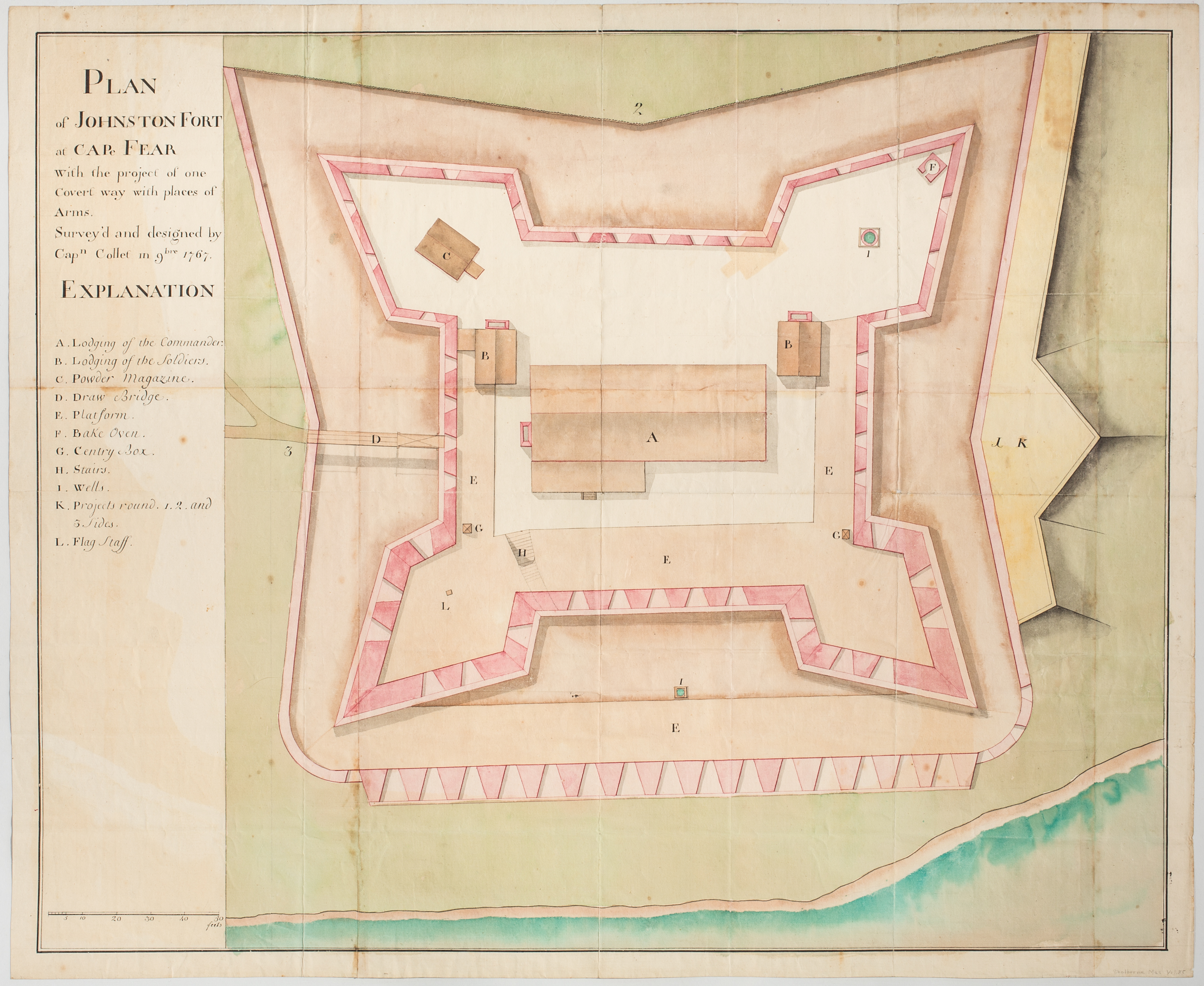
The defense of an 18th-century fort relied heavily on “bastions,” angular projections from the walls that provided broad and stable platforms for the defenders and their weaponry. Bastions were placed at corners of a fortified enclosure and laid out so that the fire of the defenders could cover all parts of the walls and adjacent bastions to prevent attackers from finding shelter or making a lodgment in the defenses. Full bastions consisted of two flanks (sides) and two faces, which, with the side open to the fort, formed a pentagonal structure. The number and design of bastions varied according to the shape and size of the enclosure to be protected. Most forts had two to five, while fortified towns had as many as needed.
The engineer determined the exact position and shape of each bastion using geometrical calculations suggested by Vauban. It was critical that the structure be placed so as to allow effective flanking fire.
Robert Stobo (1726-1770), Plan of Fort le Quesne, Built by the French at the Fork of the Ohio and Monongahela in 1754 (London, [1768]). Copperplate engraving. Map Division M-320. Maps 6-B-13.
Fort Duquesne was constructed on the future site of Pittsburgh by the French in 1754 and captured by the British in 1758. It was a simple, square fort with four bastions, a ditch, and rudimentary outworks. This plan was made by an English captive and published as historical record in the aftermath of the French and Indian War.
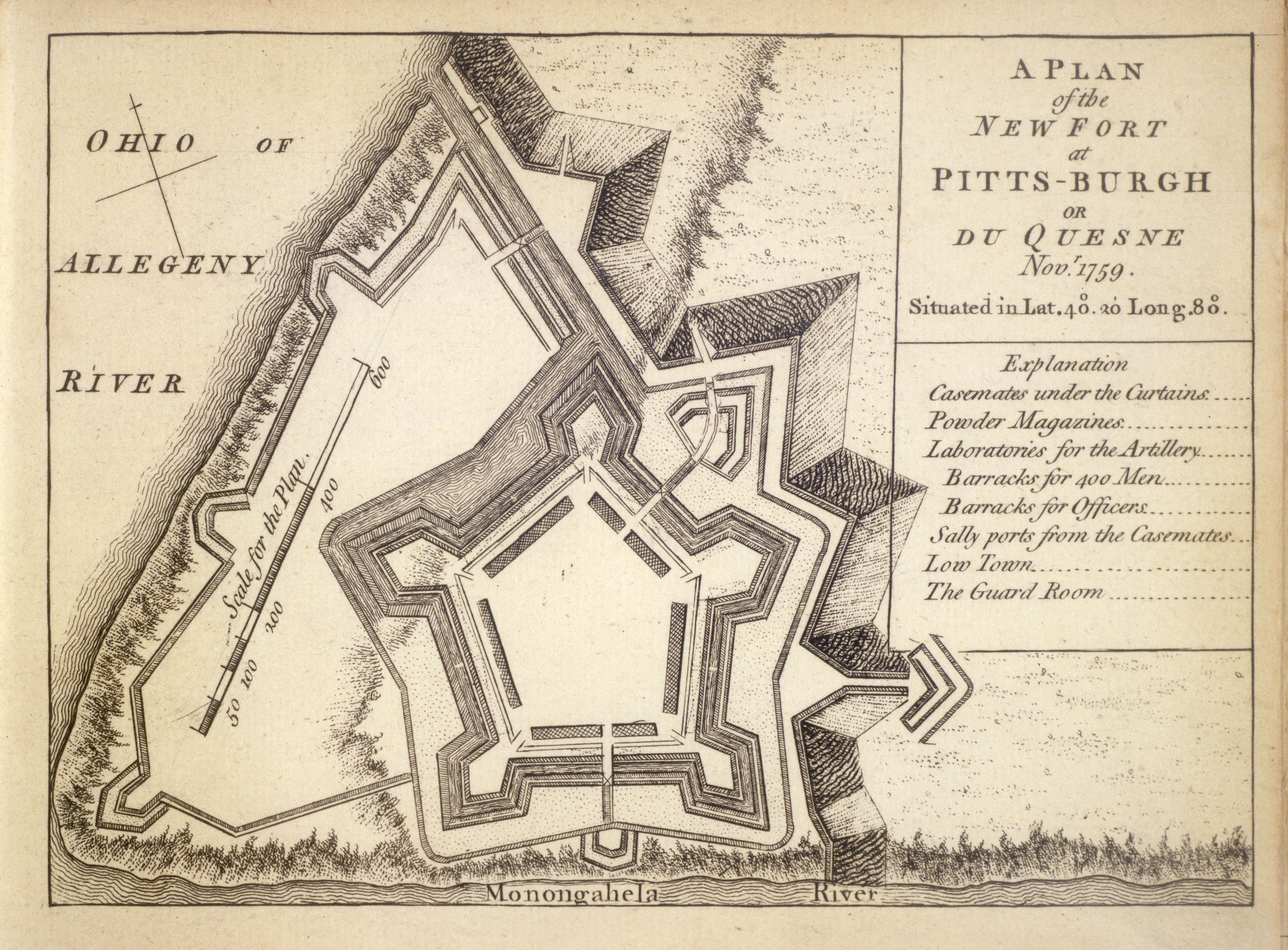
A Plan of the New Fort at Pitts-burgh or Du Quesne Novr. 1759 in Mary Ann Rocque, A Set of Plans and Forts in America. Reduced from Actual Surveys 1763. (London, 1763). Copperplate engraving. Map Division, Atlas H-1.
The British replaced the ruined Fort Duquesne with a massive pentagonal structure made of brick and earth and begun in 1759. The size of the area covered required a five-bastioned shape. The new fort’s walls and outworks were designed to resist siege artillery. The site of its tiny predecessor was in the outworks at left near the number 50 on the scale.
“A Plan of Bristol Ferry Fort.” Watercolor, pen and ink, [177-]. Henry Clinton Papers, no. 74. Map Division, Maps 3-J-5.
Simpler to lay out and construct than a full bastion, the “demi”- or “half-bastion” offered less complete flanking coverage. The demi-bastion was likely to be used in temporary field fortifications or in positions where the threat of heavy artillery was lower.
Bristol Ferry Fort was an outlying position in the British defenses of Newport, Rhode Island (occupied 1776-1779). This plan records the form of the fort and includes a cross-section of its ditch and sod-covered earthen walls.


