The Clements Library map collection comprises some 30,000 examples of cartography with American subject matter drawn or printed between the years 1492 and 1900. This body of material represents a variety of plans and maps ranging from the most detailed small-scale plan (of a formal garden or a town, for example) to dramatic large-scale wall maps representing the entire Western Hemisphere. These maps have all been drawn, carved, or printed on some form of surface—paper, vellum, glass, wood, fabric, and more. The nature of the material has something to say about what sort of use was anticipated for the map.
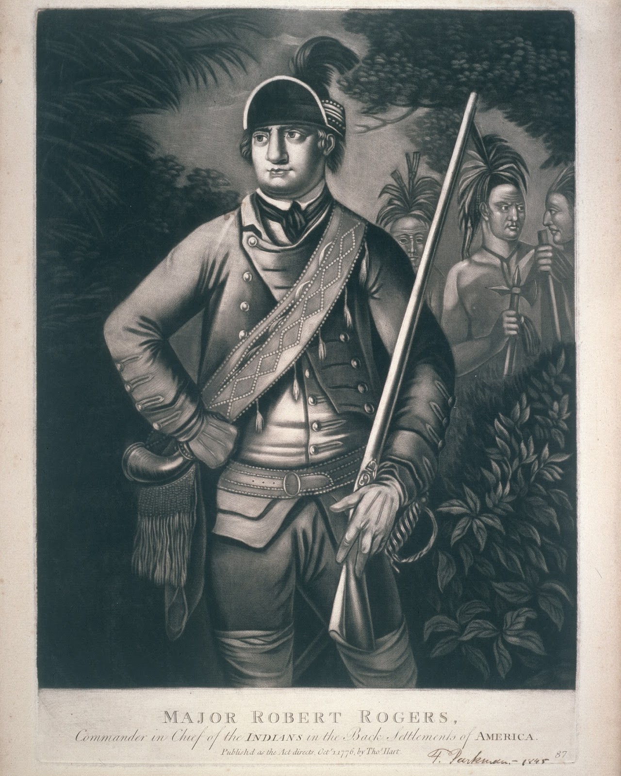 |
| Major Robert Rogers, Commander in Chief of the Indians in the Back Settlements of America. [London] : Thomas Hart, 1776. Mezzotint engraving. |
The European colonial experience in North America added another medium on which a map could be pictured. The powder horn is an iconic object of the American frontier, associated in our minds with legendary figures like Davey Crockett, Daniel Boone, Natty Bumpo, Robert Rogers, and anyone else who toted a rifle or musket into the wilderness to hunt game or wage war. No self-respecting woodland American, would think of braving the forest without a trusty firearm (Crockett’s “Old Betsey”) and well-filled powder horn. Genuine powder horns are very collectible these days, meaning that their cost is almost certain to be high and their quantity limited. Antique powder horns are also notoriously easy to duplicate, whether for legitimate use in historical reenactments or exhibits or intentional fakes. The combined concerns about opportunity, cost, and legitimacy long kept the Clements from acquiring a powder horn in its collection. Until now, that is!
The traditional American type was constructed of a bovine horn of almost any size. These were, easy enough to come by at a time when much of an army’s meat supply marched along with the soldiers “on the hoof.” When these animals were butchered for their meat, the horns were set aside for other purposes. Properly cleaned and polished horns were sought out for conversion. Once a raw horn had been cleaned and its interior cartilage removed it was further polished and a wooden butt plate was carved, fitted to the open (wide) part of the horn, and secured by tacks. The exterior was cleaned and smoothed and the spout end (the pointy part) carved to taste with a spout into which a plug, often decorative, was fitted. Then all that was lacking was fine black gunpowder for use either as priming for a flintlock mechanism or for the main charge The horn was itself waterproof, and a properly constructed plug and butt piece were at least water resistant.
But why would the Map Division be interested in a three-dimensional object, a far cry from the maps on paper and other materials? The smooth outer surface of a powder horn offered a substantial amount of empty space that just called out for some decoration. Different elements were easily carved into the horn. Geometrical figures, plants and flowers, scenes of marching soldiers, coats of arms, patriotic symbolism, and prominent buildings were among the motifs most used. Of particular interest to the Clements are those designs that dupplicate the long, sinuous shape of a waterway—the St. Lawrence, Hudson, or Mohawk rivers, Lake George and Lake Champlain—with their towns, forts, Indian villages, and battles depicted, often in great detail. What the Clements lacked is known, obviously enough as a “map horn.” Map horns usually combine elements of towns, forts, and encampments with the course of a waterway.

We are pleased to announce that we have finally bitten the bullet and acquired a map horn by purchase. It is not an eighteenth-century example, which would be the most appropriate for the collection, but we can at least show a simple example of an important American genre. Actually, powder horns were manufactured and used in other parts of the world. They were popular with artillerymen who could prime a loaded cannon by directing fine powder into the touchhole. When touched with a spark or a burning “match” the cannon throws its ball toward the enemy. Many individual map horns were carved for the owners (for a fee) by individual soldiers in camp. These usually include the owner’s name. A booming trade in horns bearing the British arms with a map was carried on by professional engravers in London and other cities.
Our new powder horn is a relatively simple example from the Civil War (1861-1865). The horn is nicely shaped with decorative elements on the butt plug. Carved around the base is a simple map of the East Coast of the United States from Charleston, South Carolina, to Savannah, Georgia. Also depicted (north to south) are “Ft. Sumter,” “Ft. Beauregard,” “Port Royal,” “Ft. Walker” “Ft. Paulaski” (sic) and “Savannah.” The name of the owner and/or maker, “Jim Reed,” is prominently displayed The dealer who sold us the horn presented it as a Confederate piece because of the subjects of the carvings. That is no guarantee, however, and it might just as well have been carved by or for a Yankee sailor. Was Jim Reed a Confederate Soldier or Yankee sailor? Did he make and decorate the horn? Did he carve the horn or pay another to do it? When did he carve it? Another Clements mystery. In the meantime, the Map Division has a powder horn as an example of a distinctive type of American map.
Brian Leigh Dunnigan
Curator of Maps & Associate Director