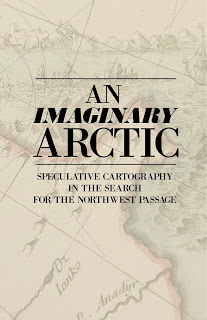
Melanie Langa, a researcher at the Clements Library and a student from Community High School in Ann Arbor, will curate an exhibit on the history of cartography beginning April 30th at the Stephen S. Clark Library in the Graduate Library. Entitled, An Imaginary Arctic: Speculative Cartography in the Search for the Northwest Passage, it will feature maps from both the Clements Library and the Clark Map Library through July.
This event is the culmination of Melanie’s research during the 2011/2012 academic year, which centered around cartographic depictions of the extreme northern reaches of the North American continent. The makers of these maps were searching for an Arctic trade route from Europe to Asia, often known as the Northwest Passage. The Northwest Passage has inspired thoughts of mystery and adventure. Maps have visualized and catalogued the search for this mythical waterway. From the 15th century, cartographic representations of the Northwest Passage has always incorporated unproven and imagined features. Despite numerous voyages, the waterways through the Canadian Arctic Archipelago were not accurately charted until the 20th century; they remained a frozen mystery long after the rest of the Americas had become well known. Maps played a vital role in both the speculation about, and the demystifying of, the Northwest Passage.
The exhibit attempts to explain the attraction of a Northwest Passage despite Arctic dangers, the ways in which cartographers represented their speculation about such a waterway, and how navigation of the Canadian Arctic Archipelago has changed and will continue to change in the future.
Melanie began her studies in the history of cartography in 2008 as part of the Community Resource program at Community High School. For the last four years she has pursued an independent study under the direction of Mary Pedley, Assistant Curator of Maps at the Clements Library with the help of Brian Dunnigan, Associate Director and Curator of Maps at the Clements Library. This course has covered a variety of subjects including foundational topics in the history of cartography, early urban plans, Native American cartography, and the cartography and exploration of the Northwest Passage.
A reception and open-house will kick-off the exhibit on Thursday May 10th from 4pm-6pm at the Clark Map Library. It will then be available for viewing during the Clark Library’s regular hours through the end of July 2012.

