Case 7: Land Speculation and the Northwest Passage
Contents
Case 1: Early Encounters - Before 1600
Case 2: Early Encounters - Samuel de Champlain
Case 3: Early Encounters - Early British and Native American Interactions
Case 4: William Penn's Treaty with the Lenni Lenape Indians
Case 6: Sacred Objects, Instruments of Negotiation, and Commodities
Case 7: Land Speculation and the Northwest Passage
Case 9: 18th Century Conflicts
Case 12: The Dakota War of 1862
Case 14: Ojibwe (Anishinaabemowin) Texts
Case 16: Recent Library Acquisitions
Indian Queens and Indian Princesses: Allegorical Representations of America

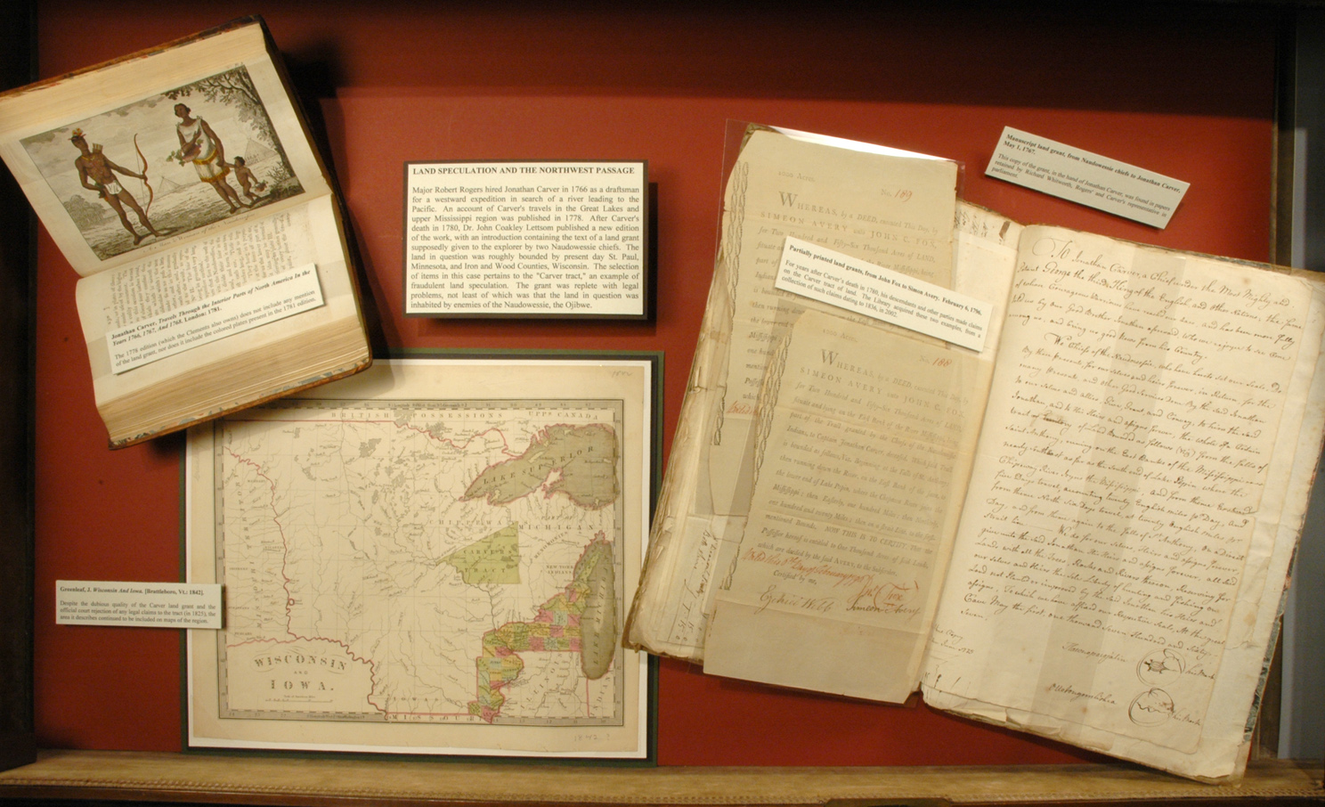
Major Robert Rogers hired Jonathan Carver in 1766 as a draftsman for a westward expedition in search of a river leading to the Pacific. An account of Carver’s travels in the Great Lakes and upper Mississippi region was published in 1778.
After Carver’s death in 1780, Dr. John Coakley Lettsom published a new edition of the work, with an introduction containing the text of a land grant supposedly given to the explorer by two Naudowessie chiefs. The land in question was roughly bounded by present day St. Paul, Minnesota, and Iron and Wood Counties, Wisconsin.
The selection of items in this case pertains to the “Carver tract,” an example of fraudulent land speculation. The grant was replete with legal problems, not least of which was that the land in question was inhabited by enemies of the Naudowessie, the Ojibwe.
Items within this Case
Manuscript land grant, from Naudowessie chiefs to Jonathan Carver, May 1, 1767.
This copy of the grant, in the hand of Jonathan Carver, was found in papers retained by Richard Whitworth, Rogers’ and Carver’s representative in parliament.
From the Richard Whitworth Papers.
Jonathan Carver, Travels Through the Interior Parts of North America In the Years 1766, 1767, And 1768. London: 1781.
The 1778 edition (which the Clements also owns) does not include any mention of the land grant, nor does it include the colored plates present in the 1781 edition.

J. Greenleaf, Wisconsin And Iowa. [Brattleboro, Vt.: 1842].
Despite the dubious quality of the Carver land grant and the official court rejection of any legal claims to the tract (in 1825), the area it describes continued to be included on maps of the region.


